

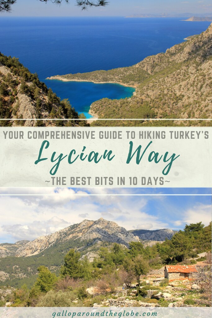
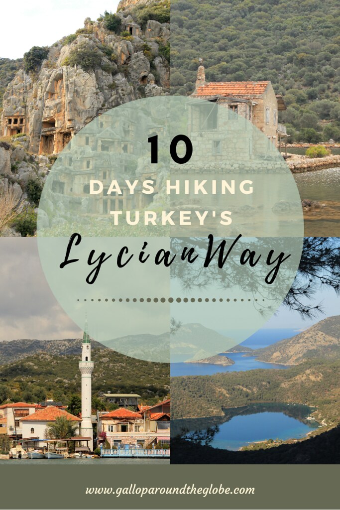
If you’re thinking about hiking the Lycian Way but are short on time, then this post is for you! My friend and I performed extensive online research in order to formulate a 10-day itinerary, covering the best and most accessible parts of the route. We hiked with just day packs and stayed at guesthouses along the way. If you’re thinking of doing something similar, to follow are all the details of our adventure 😀
Some of the links in this post are affiliate links. All this means is that if you make a purchase through one of the links I have provided, I will earn a small commission as a result but the cost to you will remain exactly the same.
Earlier this year a friend and I set out to hike the best bits of the Lycian Way trail in just 10 days. We planned to travel with just a single carry-on bag each —therefore, keeping the weight on our backs to a bare minimum — and to stay in a combination of hotels, guest houses and homestays along the way (depending upon availability).
This meant that we had to thoroughly research our route, in order to ensure that the daily distances were doable and that we could find affordable accommodation options as close to the trail as possible, at the end of each day. And, for those parts of the trail we wanted to skip (due to remoteness, lack of accommodation, or simply because they were less interesting than other parts), we needed to ensure the provision of public transport to our next destination.
And, let me tell you, this was no easy task!
Firstly, not a huge amount of blog posts have been written about hiking the Lycian Way, and, secondly, of those we did find, very few mentioned transportation at all. Perhaps people either hike the whole thing (Sarah Williams, of Tough Girl Challenges, did, and you can find her vlogs here), they simply concentrate on one particular section, or they wild camp (thus removing the need to skip sections where accommodation is unavailable).
For these reasons, I wanted to publish a comprehensive guide to hiking the best bits of the Lycian Way in just 10 days. This guide will give you information and advice about:
- the best times of year to hike the trail;
- what to wear;
- what to pack;
- the types of food and accommodation available;
- the costs involved;
- ease of navigation;
- difficulty levels and challenges; and
- the towns, villages and historical sites you’ll see along the trail.
Introduction to the Lycian Way
The Lycian Way (Likya Yolu) is a long-distance hiking trail in Turkey that’s named after the Lycian civilization who once ruled this region. The 509-kilometre (316-mile) route primarily follows the Mediterranean coastline (with a few inland mountain sections thrown in) between modern-day Fethiye and modern-day Antalya, passing ancient Lycian ruins and picturesque mountain villages along the way.
It was Turkey’s very first long-distance hiking trail, created in 1999 by British expat, Kate Clow — who, incidentally, has written the only comprehensive guide to hiking the Lycian Way.
It generally takes around 29 days to hike the entire length of the trail, walking an average of 18 kilometres (11 miles) per day. These may sound like relatively easy daily distances for the experienced hiker, but it’s important to note that the trail does not involve much level walking — there are a lot of ascents and descents involved. The path is easier at the start near Fethiye, but gets more difficult as it progresses, which is why the majority of hikers start at Fethiye.
To summarise, here are a few stats:
- Length of trail: 509 kilometres (316 miles). You’ll find variations of this distance listed online — firstly, because the ‘official’ start of the Lycian Way is actually in Ovaçik, around 15 miles from Fethiye, and secondly, because the trail was extended in 2014, and now finishes at Geyikbayırı. There are also a number of alternative routes, add-ons and diversions.
- Ascent/descent: 23,085 metres (75,740 feet) / 22,675 metres (73,385)
- Difficulty level: moderate-hard, mainly due to the constantly changing elevations and the rocky trail surface.
Hiking the Lycian Way | When to Go
Turkey can get incredibly hot during the summer months and there’s not a huge amount of shade along large parts of the trail, so I would recommend hiking the Lycian Way during the spring (March – May) or autumn (September – October). We hiked the route in March and, whilst we had a few cloudy days, the weather stayed dry and the temperatures were manageable. The mountain sections can be rather treacherous during the winter months, and I wouldn’t fancy attempting some of the descents during/after heavy rainfall!
Hiking the Lycian Way | Useful Resources
- TrailSmart app.You’ll find GPS data and detailed descriptions for each section of the route, as well as details on where to find drinking water, pensions/homestays/campsites. We used this in conjunction with the Footpath app, to navigate our way along the Lycian Way trail.
- Footpath app. I absolutely love this app and use it on every hike I undertake. Basically it allows you to draw routes with your finger, following footpaths and roads, and then makes them into a nice little route map (complete with distances and elevation) that you can follow in real time. You do have to map the route before you walk it, but I found that quite easy because it has the ‘Lykia Yolu‘ marked on it. We also found the Footpath maps a lot more user friendly than the TrailSmart app if we happened to go off trail, as they show all your surroundings as well as the route itself, so you can figure out how best to get back on the trail.
- Oanda Currency Converter app. Another app I’ve been using for years — it allows you to do currency conversions without being connected to a phone network or the internet. Exchange rates are the same as those used by auditing firms and banks.
- TripIt app. This is another app that I recommend to everyone I know who travels. It’s particularly useful for backpacking/adventure style travel, where you’re moving on to a different destination every couple of days. Or, when you’re completing a point-to-point hike, where you’re staying somewhere different every single night. All you need to do is forward any email confirmations for flight and accommodation bookings and bus/train/boat journeys to plans@tripit.com and then TripIt organises these into a handy little itinerary in the app, along with flight numbers, departure/arrival/check-in times, and hotel/guest house addresses and phone numbers.
- Trekopedia website. I actually only discovered this website when doing research for this post, and I wish I’d found it before hiking the Lycian Way! The Lycian Way section is still under development and still being added to, but all the core information you should need is already on there, laid out in a very clear manner that’s easy to read and understand. They also accept contributions (updated info/suggestions/photographs) from readers.
Hiking the Lycian Way | What to Pack
This is largely dependent upon what time of year you are hiking the Lycian Way and whether or not you’re hiking with camping gear. But, assuming that you’re hiking during spring or autumn and are doing as we did, staying in accommodation along the way, here’s what I would recommend that you pack as a bare minimum for 10 days on the trail (which is pretty much what we hiked with):
- A comfortable hiking pack. I took my 20-litre Osprey Tempest, because it fitted within the airline’s cabin bag allowance, so it meant that I didn’t need to pay any additional baggage fees.
- A comfortable, worn-in pair of hiking boots. I’ve recently bought a pair of Arc’teryx Aerios FL GTX and they’re so much lighter than my previous pair of Keens, and super grippy too!
- A waterproof jacket. I took my Inov-8 Stormshell jacket, which is the lightest waterproof jacket I own, at just 150 grams.
- Several pairs of lightweight, comfortable hiking socks.
- A comfortable sports bra.
- A pair of leggings or walking trousers — whichever you favour for hiking; I prefer leggings for comfort and ease of movement.
- 2 x lightweight, quick-drying t-shirts.
- 1 x long-sleeve top.
- 1 x fleece.
- A change of clothes for the evening, including flip-flops or sandals.
- A headtorch.
- A portable battery charger — an absolute necessity when you’re relying so heavily on navigation apps.
- A few emergency energy bars. For those occasions when breakfast is not supplied at your guest house and there are no cafes en-route for some distance into the hike.
- A reusable water bottle with filter — so that you can fill it up from any water source.
- A waterproof backpack cover.
- Toiletries. Grüum make some fantastic solid shampoo and conditioner bars.
- A lightweight down jacket, for those colder evenings. Whilst the temperatures were warm during the day, they really plummeted at night, especially up in the mountains. So, I was very grateful for my Rab microlight alpine down jacket.
- A decent pair of sunglasses.
- Sunscreen. A little goes a long way; I took just a 50ml bottle with me and still had some left at the end of the hike. But then, I did have my legs covered, so I only really used it on my arms, face and neck.
Hiking the Lycian Way | Getting There
The closest airport to Fethiye is Dalaman (approximately 45 kilometres (28 miles) away), and the closest airport to Geyikbayırı is Antalya (approximately 40 kilometres (25 miles) away), but we found cheaper flights in and out of Antalya, and then caught the bus across to Fethiye to start our walk. It all depends on where abouts you’re flying from and what works for you. I always check Skyscanner to research flights and Busbud to research buses. Rest assured, there are plenty of buses to Fethiye from either Dalaman or Antalya airport.
Hiking the Lycian Way | Getting Around
Obviously, if you are hiking the Lycian Way from point A to point B, you won’t need public transport. But, because we’d decided to hike the best bits of the Lycian Way, we were reliant on public transportation to get us past the less interesting and least accessible parts of the trail.
As I said in the introduction to this post, finding any information online about public transportation along the Lycian Way proved incredibly challenging. Some articles suggested that local minibuses (dolmuses) ran frequently along most stretches of the Lycian Way and that you could just hop on and hop off to get to where you needed to be. Whereas others indicated that they only ran between the major towns and cities. We found dolmus stops marked on lots of the maps we checked, but could not find timetables anywhere online.
We flew out to Turkey, hoping there would be more information available on the ground when we arrived (speaking to local residents, shop, café, and guest house owners etc), but being prepared to wing it if we had to. And, we definitely had to on quite a few occasions!
Hiking the Lycian Way | Accommodation
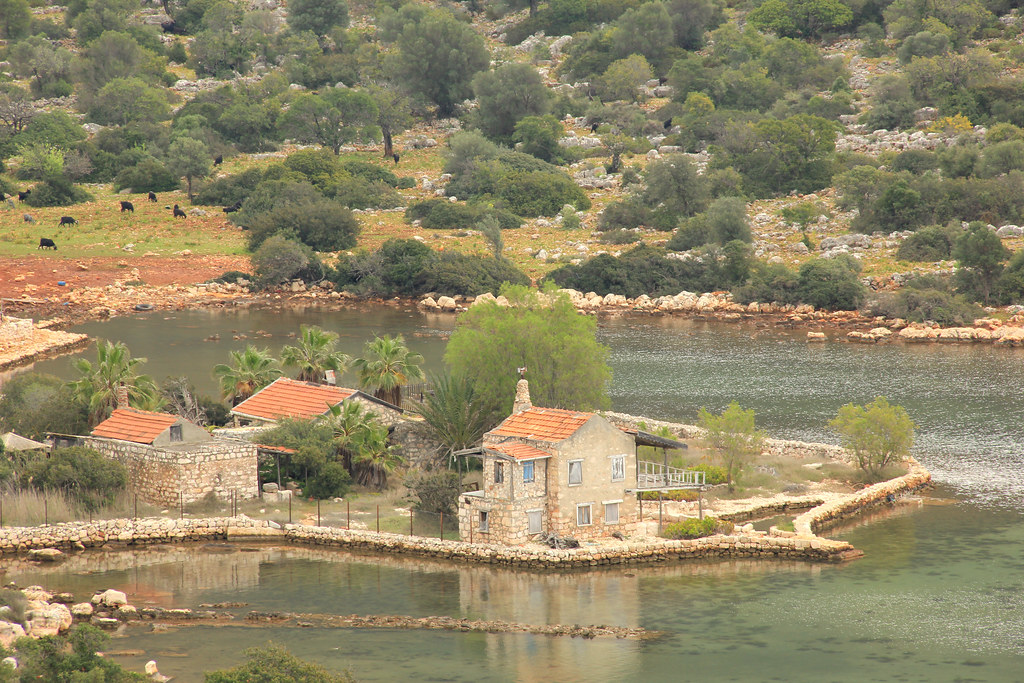
Accommodation along the Lycian Way ranges from upscale hotels and luxurious villas (in Kalkan, for instance) to very basic homestays and wooden mountain bungalows like those we stayed at in Bel and Kabak respectively. We booked those we could on booking.com. However, there were a few smaller towns/villages along the trail where we simply could not find any accommodation listings on Booking (or, in fact, any of the other sites we checked). For those, we relied upon recommendations from others in online communities, along with listings on the TrailSmart app mentioned earlier in this post.
Here is a list of all the places we stayed at along the Lycian Way, Turkey:
- Fethiye | Nefis Hotel City. One of the cheapest places we could find in Fethiye (we paid just £26 for our twin room in March 2023) that also happened to be just steps from the start of the trail. Considering the price, we were really pleasantly surprised by the standard of this hotel. We didn’t arrive until after 10 p.m. but the reception staff still happily brought us some much-needed coffees and sold us a couple of soft drinks to take up to the room. There’s also a lovely roof terrace, where the inclusive breakfast is served every morning. It’s only a 15-minute walk from the bus station, too.
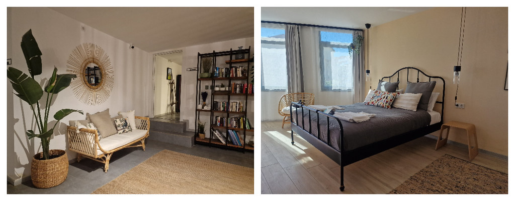
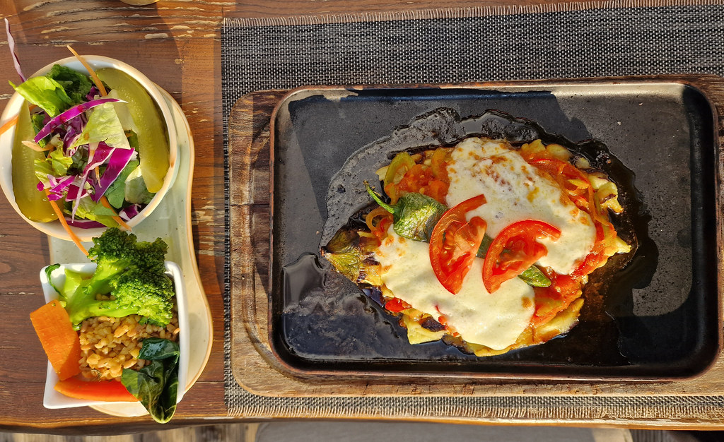
- Ovaçik | Gold Lion Hotel. Again, we chose this place primarily because of its proximity to the trail. And again, we were super impressed by what we got for our money. €36 (around £30) bought us this amazing room (pictured below) with a huge bathroom (not pictured). Ok, so breakfast was not included, but the hotel manager/owner kindly drove us up to a restaurant in the main part of town (albeit only a 10-minute walk, if we had made the journey on foot) so that we could grab some dinner on the evening we arrived. He happily waited around and caught up with a few friends before driving us back after our meal.

- Kabak | Shiva Camp. Whilst there was rather a lot of building work going on during our stay (I imagine they were giving the site a bit of a spruce up in time for the hiking season peak later in the year), which meant that the camp wasn’t perhaps as ‘idyllic’ as the online photos suggested, the pool was not open and the restaurant was not operating a full service, we could still appreciate Shiva Camp’s beautiful setting, high above Kabak Bay and with views out to sea. The owner Samim was also the sweetest, most trusting guy we met on the trail. He had no facility to take a card payment for the room, and we didn’t want to part with the majority of our cash just as we were going into a particularly rural section of the hike, so he gave us his bank details and we promised to do a bank transfer as soon as we got back into the land of reliable wifi. He even packed us a breakfast to walk with.
- Bel | Fatima Pension. We only actually spotted two places to stay in the tiny, picturesque village of Bel, and Fatma’s was one of them. Although very basic in terms of creature comforts (the shower was rather temperamental and there was no heating in the room (but we did have plenty of blankets)), we couldn’t have asked for a warmer welcome from Fatma. The pension is owned by Fatma and her husband (he looks after the land and the goats, and she looks after the home), all the food they supply is homegrown and homecooked, and Fatma loves to hang out and chat to her guests — despite a rather limited command of the English language! This was the cheapest place we stayed along the trail, at just £17 per night, including breakfast and an evening
mealfeast. - Kalkan | Payava Hotel. This was our one splurge on the trip, mainly because we couldn’t find anything cheaper that was remotely close to the trail. But, wow — it was beautiful! Our room was massive, and bright and airy with a small balcony and sea view, there was a lovely sunny terrace upon which to enjoy a late afternoon beer, the included breakfast was amazing, and the staff were super friendly, accommodating and helpful (even in spite of the fact that we weren’t dressed to the standard of their usual clientele!). Although we paid £65 for the room, I do feel that we got value for money.
- Kas | Mare Nostrum Apart. Considering the popularity of Kas as a tourist destination, we couldn’t believe what an absolute bargain we scored in Mare Nostrum! We paid £51 for two nights (as we’d factored in a rest day in Kas). The rooms here are built around an attractive shaded courtyard, and the whole place is lovely and peaceful, despite only being a stone’s throw from the main street leading down to the harbour. There’s a supermarket just 100 metres away and the bus station is only 60 metres further, so we couldn’t have asked for a better location either.
- Demre | Santa Suites New Hotel. Although an overnight stay in Demre cannot be avoided when hiking the Lycian Way (the Myra ruins are close by and are an absolute must-see!), it’s a pretty soulless place that doesn’t seem to serve coffee before 9 a.m. and whose best-rated restaurant is average at best. Considering this, our accommodation was actually pretty nice, and a lot better than it looked from the outside. It’s just a five-minute walk from the bus station, around a mile from the trail, and also probably one of the better places to stay in the city (not that there’s a great deal of choice!).
- Adrasan | Duran Pansiyon Bungalow. Our check-in here didn’t get off to the best start — we arrived to find the site completely devoid of staff or guests and had a brief panic that we’d be sleeping on the beach, because nothing else seemed to be open either! However, we later discovered that the owners actually live off-site and we were meant to send a message to confirm our arrival 24 hours beforehand. So, all was well once the owners arrived. We seemed to be the only guests there though! Our little wooden bungalow was actually quite cosy, and we enjoyed the inclusive breakfast spread and resident cat.
- Cirali | Alican Pension. All the rooms here have their own little balcony overlooking the guest house’s pretty garden, which is where the inclusive buffet breakfast is served every morning. Whilst the rooms are basic, they were perfectly sufficient for what we needed, and we liked the location of Alican Pension — hidden away on a little backstreet about half way between the beach and the main street.
- Antalya | Mai Inci Hotel. Although we paid £40 for a twin room here (which was at the upper end of our nightly budget), we felt it was on a par, in terms of luxury, with our room in Kalkan (which we paid £15 more for). The gentleman at the reception desk was super helpful, friendly and patient with us, the inclusive buffet breakfast was amazing, and we had a complimentary session at the hotel’s spa (to use the pool and sauna) included in our room rate. On top of that, the hotel is just minutes from bus and tram stops (for getting to/from the airport) and around a five-minute walk to the harbour, old town and bazaar.
Total accommodation costs for 11 nights = £354 for two people (so, £177 each)
Hiking the Lycian Way | Our 10-Day Itinerary
Although we thought we had a rock solid itinerary when we left the UK to start hiking the Lycian Way, things didn’t quite go to plan when we got there. Firstly, because Jayne sustained a knee injury on the descent from Bel to the Pydnai ruins/Karadere (which meant that we had to adjust the rest of the itinerary to avoid any steep/long downhill sections and just long days in general) and secondly due to elusive dolmuses (local mini buses), and a lack of timetables/bus stops/available info from locals.
Seeing as though I can’t write about parts of the trail I haven’t walked, the itinerary I’m sharing below will largely reflect the one we actually followed (rather than the one we planned for), but with suggestions for how you can tweak it to improve your experience.
Day One | Fethiye to Ovaçik (Ölüdeniz) – 14.3 kilometres (8.9 miles)
Recorded distance walked on Strava: 16.4km (but we veered off-track to explore the ghost town of Kayaköy) | Elevation gain: 795m | Time: 4h 9m
The primary reason we started hiking the Lycian Way in Fethiye rather than Ovaçik was so that we could visit the ghost town of Kayaköy. And I’m 100% glad we did, because I loved Kayaköy! Exploring abandoned places piques my curiosity and imagination.
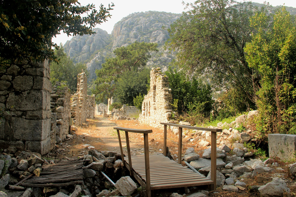
Whilst I wouldn’t describe the rest of this section as spectacular, it does make for a lovely little warm up, and you will pass some impressive rock-cut tombs and a viewpoint that affords some stunning views down on to Fethiye Bay along the way.

When you set off, you’ll walk along the road for a little while until you reach the trailhead. Just past the trailhead is (what’s left of) Fethiye Castle and the viewpoint from where the above shot was taken. Continue a little further uphill (yep, the first three-ish kilometres of today’s hike is pretty much all uphill!) and you’ll branch off to the left and enter a dense forest.
This section of the trail was rather disorientating in parts, but it helped that we were following the route on two separate apps — TrailSmart and Footpath — and could therefore ensure that we stayed on track.
You’ll eventually re-join the road for your arrival into the town of Kayaköy. It had started raining at this point so we took up residence in a local cafe while we waited for the storm to pass. Coincidentally, the cafe we stopped at belonged to a Kayaköy guesthouse we’d previously bookmarked when researching accommodation along the trail.
Once the rain had eased off a little, we headed on to explore the ghost town of Kayaköy, located on the southern edge of town.
Originally known as Levissi, the abandoned village dates back to the 14th century. Anatolian Muslims and Greek Orthodox Christians lived harmoniously alongside each other in a thriving community that was once home to around 10,000 people.
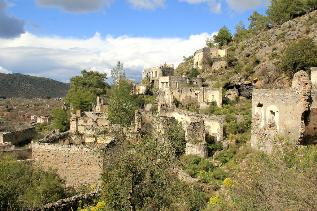
Kayaköy was forcibly abandoned at the end of the Greco-Turkish war in 1922. Christians were obliged to leave the country and move to Greece, whilst Muslims were permitted to stay in Turkey, so that each country could claim its one major religion. Levissi then became Kayaköy (Rock Village). Whilst a few Muslims remained in Kayaköy, those arriving from Greece did not join them, due to the village’s remote hillside location.
As such, Kayaköy’s population diminished, and the village was completed abandoned by 1923. A major earthquake in 1957 caused significant damage to many of Kayaköy’s buildings, and in the 66 years since then, the village has just been left to weather and decay. The site is now under the protection of the Turkish government and an admission fee applies.
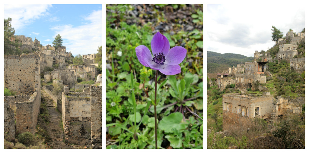
The Lycian Way trail actually takes you through the abandoned village of Kayaköy, so make sure you’ve got enough cash on you to cover the 50 TL (correct, Match 2023) entrance fee. That said, you’ll only see a small section of the village if you stick to the trail, which is why we ended up walking an additional two kilometres on our first day of hiking the Lycian Way!
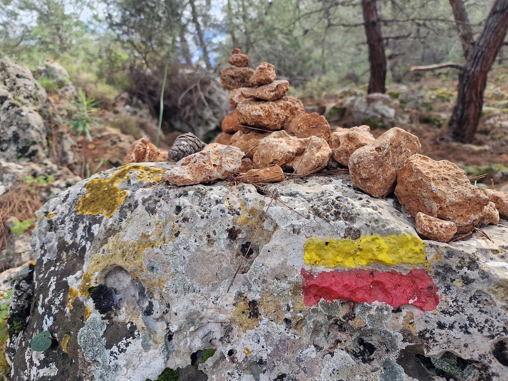
At one point, we realised we were on the ‘alternative’ trail (indicated by red and yellow markers as opposed to red and white), heading down to the beach at Ölüdeniz. We’d previously decided against following this route, because it adds a fair bit of distance on to a day that is already nine miles long, and we wanted to ease ourselves gently into the trail. We also didn’t fancy staying in much-more-touristy Ölüdeniz overnight, or the climb back up from the beach the next morning. So, we aborted and rejoined the correct path!
When we arrived into Ovaçik, we’d planned to stop for a drink and a bite to eat before checking into our hotel. But all the cafes and restaurants we passed appeared to be closed (temporarily or permanently, we don’t know!). We asked the gentleman who showed us to our room if he knew of anywhere open, but his English wasn’t quite up to providing us with an answer or directions.
What he did do, though, is phone a friend of his, who drove us to nearby Abrahkebabrah Restaurant for dinner. Although the place seemed to be full of English expats, the food was traditional Turkish fare, and was actually really good.

Day Two | Ovaçik to Kabak – 17.6 kilometres (11 miles)
Recorded distance walked on Strava: 20.62km | Elevation gain: 883m | Time: 5h 11m
Although today’s hike started off relatively flat, it wasn’t long before we were feeling very grateful that our muscles had been sufficiently warmed up on the previous day’s leg between Fethiye and Ovaçik. After around two kilometres from the trailhead at Ovaçik, we began our ascent of Babadağ (‘Father Mountain’). It’s not a technical ascent, but it is a relentless climb. In fact, we didn’t stop climbing for around four kilometres!
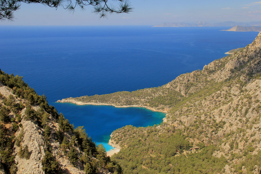
The rewards, of course, were the stunning coastal views — starting with this one of the Ölüdeniz lagoon.

You’ll also be able to spot paragliders above you as they descend from launching points on Babadağ mountain down to the beach at Ölüdeniz.
The trail finally levels out as you approach the hamlet of Kozağaç. Having not eaten breakfast that morning (due to the hotel not serving it and none of the nearby cafes being open), we were desperately in need of some sustenance by the time we arrived here, and rejoiced when we saw the first sign for a cafe 600 metres ahead.
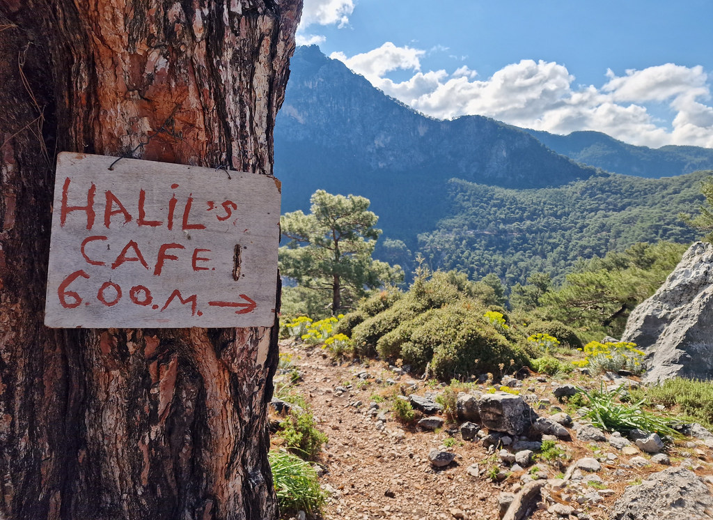
The cafe we stopped at wasn’t actually Halil’s; that was a bit further along. But, we were more than happy with Çeşme Başı Café. Their sunny, covered terrace affords some spectacular views of Babadağ mountain, the staff here are lovely (despite only speaking very limited English), and the food is freshly-made and delicious.
The laminated menus are only in Turkish, so you may need to make use of Google Translate if you have sufficient data. But, if not, I can 100% recommend ordering an Otlu Peynirli Gözleme (herbed cheese pancake). You can even watch yours being cooked, and the staff don’t mind you videoing the whole process either (although, always ask before you start filming).

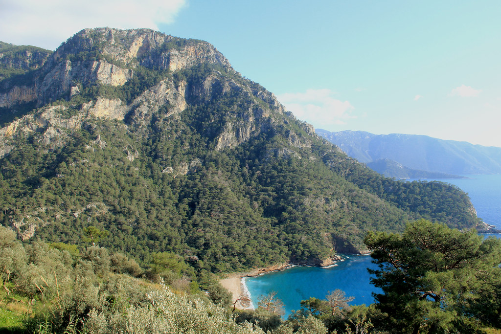
Sufficiently fed and watered, we dragged ourselves back on to the trail, very aware that we still had the majority of today’s distance still to cover. But, the good news was that we’d got the majority of the day’s climbing out the way already, leaving a rolling plateau through to Kirme and then a descent of about 12.5% down the south side of the mountain towards Faralya. There’d be a little more uphill between Faralya and Kabak, but nothing compared to this morning’s ascent.
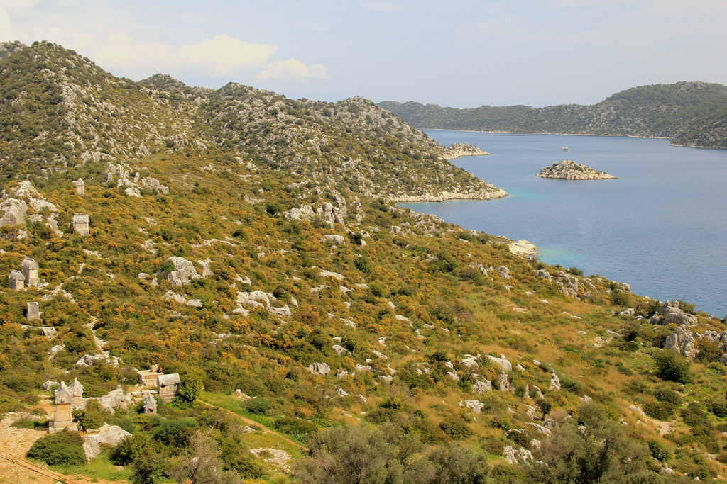
In Kirme, there are a couple more cafes and a small shop. But, we continued on to the village of Faralya, where you’ll find Butterfly Valley — one of the most photographed spots along the Lycian Way. And, on a clear day, when the weather is good, it’s very easy to see why.

Whilst it is possible to descend down to Butterfly Valley from Faralya, the descent is very steep, and is considered dangerous if you are not an experienced climber, because it involves a fair bit of scrambling and the use of ropes. We decided not to chance it, and have since read about a hiker being found dead in Butterfly Valley in October 2022.
Another option, if you’d like to get a bit closer to Butterfly Valley is to follow the alternative Lycian Way path that takes you to Kabak Beach. However, this is an additional 5 kilometres (3.1 miles) and a lot more ascent and descent compared to the main trail. We enjoyed the main trail, but we may have enjoyed this route better; who knows! If you’ve walked the alternative path, let me know what you thought!
As we continued on in the direction of Kabak, the wonderful views stayed with us. The terrain on this part of the trail generally consists of a mix of rural roads, forest trails and meadows, and is mostly well-marked. It’s not uncommon to spot beehives just off the path. Baklava (layers of honey-soaked flaky filo pastry filled with crushed nuts) is a popular dessert here.

One of the less common (if not downright bizarre) sights we passed was this antiques shop, pictured below. It was right on the trail and nowhere near any towns or villages!

When we arrived into Kabak and checked into our room for the night at Shiva Camp, we were disappointed to learn that the advertised bar and restaurant there weren’t open, so we showered and then went in search of somewhere that would serve us a nice cold beer (this quickly became a tradition at the end of each day of hiking the Lycian Way).
We made a beeline for the first place we came across, which happened to be Olive Garden. And, let me tell you, if I ever return to this part of Turkey, I’m staying here!
This boutique hotel and restaurant offers standard or luxury wooden bungalows (complete with private patio or balcony), nestled in lush and colourful gardens. There’s a stunning infinity pool and a decked area with seating overlooking Kabak Bay. And that is precisely where we took up residence for the next few hours.
One beer turned into two and then we decided we may as well stay for dinner as well.
We both ordered Imam Bayildi (roasted eggplant stuffed with onions, tomatoes and peppers and topped with cheese) and we both agreed that it was easily THE best meal we ate in Turkey!
I can 100% recommend that you end your second day of hiking the Lycian Way here at Kabak’s Olive Garden!
Day Three | Kabak to Bel – 19.9 kilometres (12.4 miles)
Recorded distance walked on Strava: 21.96km | Elevation gain: 1243m | Time: 6h 18m
Considering that today was already set to be our longest day on the trail so far (and the hilliest!), we decided against following the main path down to Kabak beach (as this involves a steep descent and subsequent ascent), and instead took the alternative route to Alinca, along the ridge. If you have time, the climb back up from Kabak beach to Alinca is reportedly lovely; some say nicer than the ridge path.
The alternative route sees you climbing as soon as you leave Kabak, so we found ourselves reaching for the breakfast kindly packed for us by our host at Shiva Camp much sooner than we’d anticipated. We’d have struggled with the ascent with no food in our bellies.
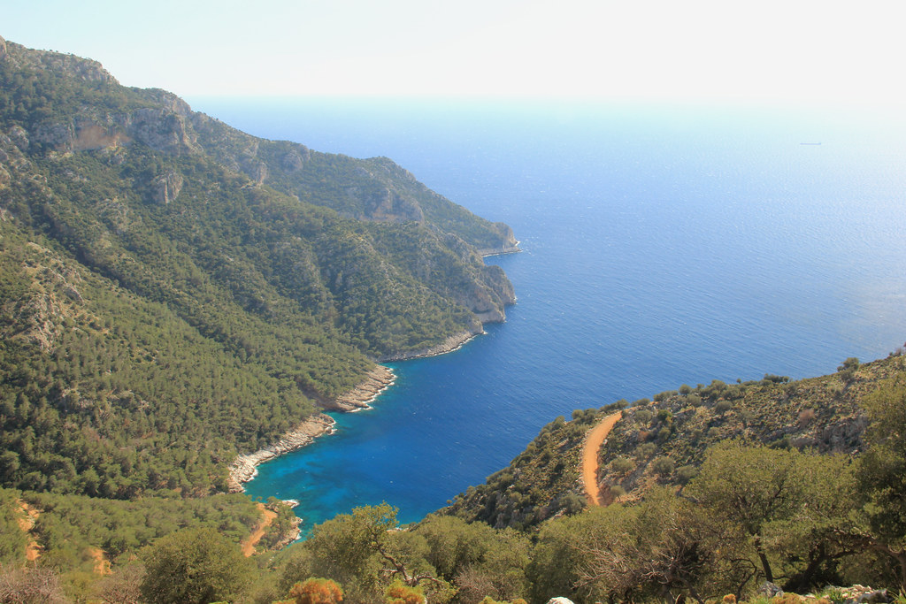
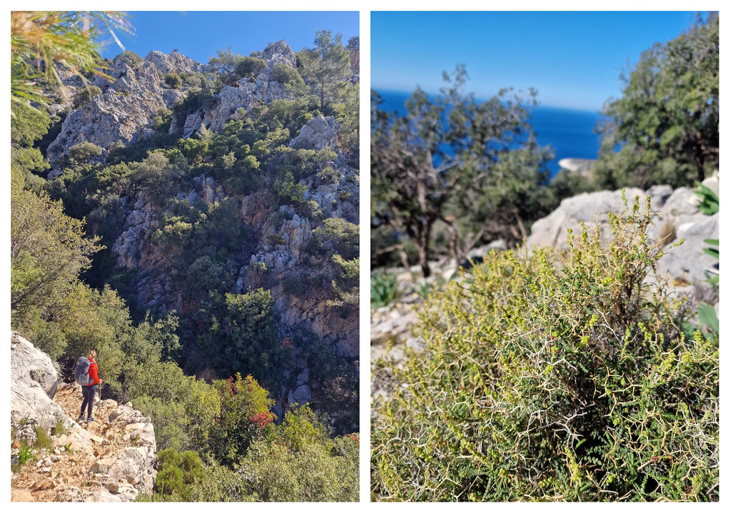
The majority of the initial section of the Kabak to Alinca path is made up of rolling small-but-steep hills following a ridge overlooking the coast. The views are truly breathtaking but you do have watch your footing because the paths are narrow and rocky and the drop is sheer!
As we joined the road for our approach into Alinca, we passed a café/beverage stand, where an elderly lady was handing out samples of her home-made lokum (Turkish Delight). We gratefully took a piece each, but didn’t stop for a drink because we didn’t want to take a break until we reached Alinca.
We hadn’t realised that we were pretty much in Alinca at that point. It’s one of those blink-and-you’ll-miss-it kind of places. We would’ve returned to that sweet old lady’s cafe, had it not meant walking back uphill, so, instead we ended up at a fairly non-descript cafe as we exited the village.
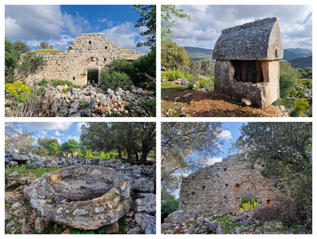
The scenery continued to wow us as we followed the main trail towards Gey (there is an alternative that goes to Dodurga, via the Sydima ruins). The path clings to the edge of the cliff, passing the rather aptly named ‘stone over the abyss,’ before dropping down (quite steeply at first) into the valley and subsequently proceeding through acres of lush farmland.

There’s a lovely little cafe right on the trail as you walk through the village of Gey, so that’s where we stopped for a rather late lunch, before setting off in the direction of Bel.
Keep your eyes peeled for these ancient Ottoman water cisterns as you leave the village.

The next section of the Lycian Way continues along much the same vein as the last — a downhill section, followed by a few undulating sections in the middle and finishing with a steady climb up into the village of Bel.
You’ll walk through some beautiful terraced farmland, with the mountains providing a picturesque backdrop.

The only problem with traipsing across farmland is that it’s very easy to get lost. There are often no defined pathways and the red and white blazes are either not at frequent enough intervals, not in the most useful of positions, or just very difficult to spot.
We were using both TrailSmart and Footpath apps to help us navigate the trail, along with the trail markers themselves, and we still found it difficult to figure out exactly where the path was supposed to be at several points during today’s hike.
My advice would be to regularly check your GPS tracks (more regularly then you usually would), because it’s so easy to go off-path without realising it in areas like this.
On the ascent towards Bel, you’ll pass yet more stunning viewpoints before the trail disappears into some densely forested areas for the final part of the climb.
I cannot tell you how pleased we were when we eventually popped out on to the road, signalling our approach into Bel. Fatma’s Pension was A LOT further away than that wooden sign propped up against a tree indicated it should be!
In the evening, we shared a huge Turkish feast that Fatma had prepared and cooked for us, using ingredients grown on her land and milk from the goats her husband tends to. It was cold up in Bel, but the fire in the living/dining area at Fatma’s kept the room lovely and warm, and the seemingly endless supply of sweet black tea was just what the doctor ordered.

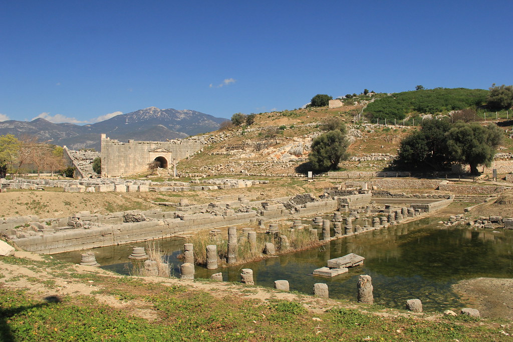
Day Four | Bel to Patara West (Pydnai Ruins) – 13.34 kilometres (8.3 miles)
Recorded distance walked on Strava: 14.89km | Elevation gain: 369m | Time: 3h 52m
Following an amazing breakfast spread, courtesy of Fatma, we said our goodbyes this morning and continued on our way. This was the first day on the Lycian Way that we wouldn’t be walking all the way to our final destination that evening. The reason? Well, there are a couple actually:
- The region between Letoon and Kalkan is “largely a delta with an endless sea of white greenhouses” (Trekopedia), with lots of road walking. Aside from the three notable ancient cities (Letoon, Xanthos, and Patara), we’d read that there wasn’t much of interest in this section. When we were walking the Hadrian’s Wall Path, we decided that we were there primarily to walk the trail, and if we had time to spend time at the Roman ruins, then that was a bonus. We applied the same strategy to hiking the Lycian Way — we decided to place higher importance over the trail sections as a whole, rather than individual sights along the trail (which we wouldn’t have much spare time to explore anyway).
- Accommodation in this section is few and far between. Upon leaving Bel, we’d have had to walk 25.3 miles (to Üzümlü) before we found anything that wasn’t a campsite along the trail. There were a few places off-trail but this would’ve added extra distance to our days. It just wasn’t feasible.
So, we set off from Bel towards Patara West/Karadere, where we’d read that there was a dolmus stop and a campsite with attached café (Patara Green Park). We figured that the staff at the campsite would probably have information about when the buses were running, if there was no information at the bus stop itself.
Things didn’t work out quite as planned; keep reading!
The section between Bel and the tiny hamlet of Belceğiz follows rural roads the entire way, so we were able to make good time over this part. However, this made us a little complacent and, therefore, ridiculously unprepared for the monster descent that followed. It’s not simply the gradient you have to deal with (averaging around 22% but with long stretches exceeding 30%), but the terrain underfoot — which is incredibly rocky and uneven, and tough on the knees! Jayne can attest to this, as it’s this very descent that buggered up her knee. She struggled to put much pressure on it from this point forward.
There is one particular stretch with a series of flat-top rocks on a pretty steep incline, where you’ve just got to hope that the boots you’re wearing have good grip. Fortunately, ours did!
On the few occasions that I did take my eyes off the path at my feet, I did notice the fantastic views out to sea. However, the reason I don’t have many photos of this section is because I was too frightened of losing my balance if I actually stopped to reach for my camera.
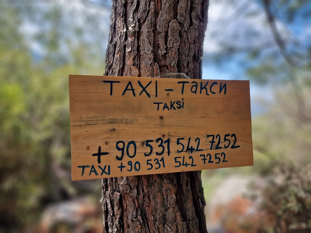
When we reached the village of Gavurağılı, we were in desperate need of a break. Fortunately, we spotted the Lykia Inn just off the trail. We were served by a gentleman who introduced himself as Hamish McTurk — a Turk with Scottish roots or a Scot with Turkish roots, we weren’t sure. He definitely had some Scottish colouring about him, but not the remotest indication of a Scottish accent. He informed us that he works as a tour guide in the local area and asked us where we were walking to today. We told him our plans and he offered us his card, in case we needed a taxi service at any point.
Little did we know how soon we’d actually need to take him up on his offer.
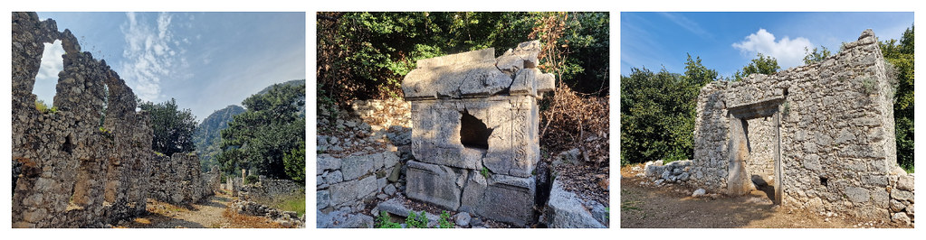
Upon leaving the café, we had one more hill to climb and descend before the path levels out upon arrival at the Pydnai ruins. The Lycian Way runs straight through this largely unmaintained and unrestored site, including through a portal in the wall of one of the overgrown structures. If you’re wearing a large pack, you’ll definitely need to remove it in order to squeeze through the gap!

I’d have liked to have had a better look around this ruined fortress, but when I veered slightly off path a little to explore one of the buildings, I realised I’d lost Jayne. Her knee was causing her so much pain that she’d walked on ahead, determined to get to Karadere as quickly as possible so that she could stop and rest.
The path is not well-marked between the Pydnai ruins and Karadere and passes through a lot of overgrown vegetation, so, once I’d caught up with Jayne, we weren’t even sure we’d make to the beach at Karadere, let alone find onward transport.
We rejoiced when we spotted Patara Green Park campsite ahead, but our hearts quickly sank when we realised it was closed. At that point, we just assumed that it probably opens later in the season (we rocked up here on the 20th of March), but we later learned that it’s actually been closed since lockdown.
So, we walked down towards the apparent location of the bus stop, marked on my Footpath app as ‘dolmus to Kinik/Fethiye,’ with a nice little picture of a bus beside it. However, we could find no bus shelter, no signage no timetables, and not a soul around to ask. Our options were to wait around and hope that a bus turned up (we had no way of finding out how long we’d have to wait or whether a bus would arrive at all) or to contact our friend, Hamish McTurk.
In hindsight, we’re aware that Hamish did very well out of us that afternoon (there wasn’t much point trying to haggle the fare down because he was our only option) but, on the plus side, he did make several stops (at Xanthos, Letoon, and one of the countless greenhouses we passed) on the way to Kalkan.

Day Five | Çukurbağ to Kaş – 7 kilometres (4.3 miles)
Recorded distance walked on Strava: 6.80km | Elevation gain: 70m | Time: 1h 38m
As you can probably tell by the short distances above, this was not our planned itinerary for day 4; we had to shave a significant distance off the beginning of today’s hike due to having an injured hiker.
The original plan was to walk from Kalkan to Saribelan, via the mountain villages of Bezirgan (14.6 kilometres/9.1 miles), and then get a taxi or dolmus to the junction south-west of Pinabarsi (for the Phellos ruins) and to continue on foot down to Kaş (a further 7.95 kilometres/4.94 miles). But the Kalkan to Saribelan leg is a ‘challenging’ section that is apparently not well waymarked. It’s also a pretty long section for someone with a knee injury to attempt, with no option to shorten it mid-way.
So, reluctantly, we agreed to catch the bus all the way to Kaş (the bus stop is literally opposite Migros Jet, marked on the map below), check into our accommodation for the next two nights (as we’d factored in a rest day in Kaş), and then catch a dolmus up to Çukurbağ, and walk back to Kaş. This short section reportedly offered stunning views looking down over Kaş, and although we knew it was going to be steep, we’d be able to take our time due to the significantly reduced distance involved.
The staff at Mare Nostrum helped us with the pronunciation of Çukurbağ, so that we were able to ask the staff at the bus station, if no timetable was available. Thankfully, there were both timetables and helpful bus drivers available.
All the reports we’d read online suggested that the descent from Çukurbağ to Kaş was going to be akin to the steepness of the trail from Bel to Gavurağılı, so we imagined getting so far and then having to turn back due to Jayne’s bad knee. We snapped some views of Kaş at the start of the trail, and it’s a good job we did because we didn’t need to turn back. In fact, we couldn’t really see what all the online fuss was all about.

The trail from Çukurbağ to Kaş is a switchback all the way, which significantly flattens out the descent. Perhaps it’s a little trickier with a heavy pack, but we’d definitely experienced much worse while hiking the Lycian Way!
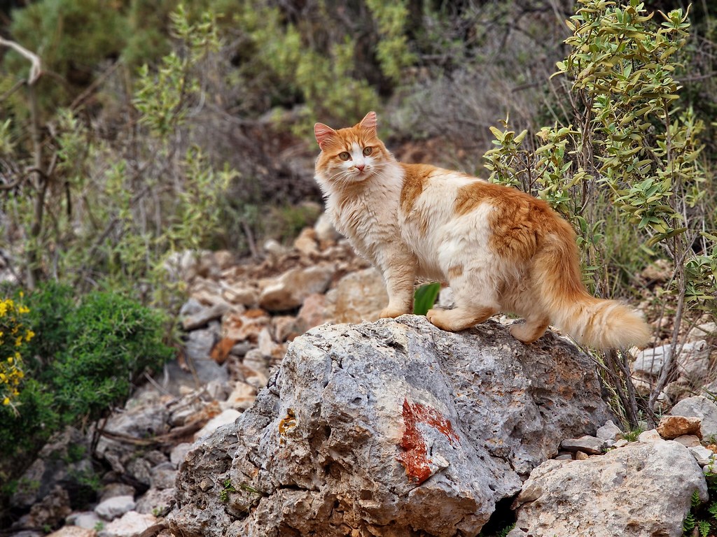
Whilst we’d encountered a fair few goats along the trail so far (along with a few tortoises too), we never expected to meet a furry feline companion as far from civilisation as the one we spotted at the top of the descent down to Kaş. What’s more, it followed us half the way down the mountain like a dog would do. Very bizarre but, for a cat lover like me, a very welcome encounter.
Day Six | Kaş to Limanağzı loop – 9.62 kilometres (5.98 miles)
Recorded distance walked on Strava: 12.90km | Elevation gain: 366m | Time: 3h 10m
Today was meant to be our ‘rest day’ in Kaş. We’d hoped to be able to find a boat to take us out to the Sunken City of Kekova. However, we hadn’t accounted for the fact that it was still low season and, therefore, no boat trips were running. Feeling at a bit of a loss about what else to do, we went for a hike!
We stuck to a flattish section, which is actually the first part of the trail when leaving Kaş and hiking the Lycian Way from west to east. However, rather than continuing on to Boğazcık (which is a very remote section), we returned to Kaş via an alternative path (the one hikers are advised to use in bad weather).
The Kaş to Limanağzı section primarily consists of walking along rural roads or rugged off-road trails, with one small cliffside stretch requiring the use of ropes attached to the rocks (more on that shortly!).
You’ll walk right beside the coast for the first part of the trail before climbing slightly inland when you reach Büyük Çakil beach. It was at this point, as we were wandering past a few houses, that we met our little canine companion. We gave him a bit of fuss before continuing on our way. But, he started to follow us.
Thinking that he belonged to a resident of one of the nearby houses, we assumed that he’d return home once we’d left all signs of civilisation behind and begun to follow the trail off road.
He didn’t.
He continued to follow us right up to the point when the trail required us to scramble down over some large rocks. Our legs were only just about long enough to reach each foothold; his, sadly, wouldn’t have been.

As we approached Limanağzı, we reached the rope section we’d read about.
It was a bit tricking manoeuvring my body around protruding rocks and attempting to keep my feet on the ledge whilst simultaneously holding on to the rope, but I made it across without too much trouble, expecting Jayne to be following behind me.

However, she was still stuck on the far end of the ledge, paralysed with fear.
I didn’t quite know what to do (I’m normally the one in Jayne’s position when I’m travelling with Stu) — if we didn’t make it past this section, we’d have to turn around and return the same way. Not a great problem, but a bit annoying when we were so close to the turn off from where we could complete the loop.
So, I made my way back across the ledge and grabbed Jayne’s backpack from her, hoping that would make the crossing a little easier. Unfortunately it didn’t. But, after a few deep breaths and slow steady steps shuffles, Jayne made it across, and we were able to continue along our way.
If you’re doing this section with a heavy pack, be very careful.

We stopped to appreciate the beautiful views of Limanağzı bay, before heading inland and making our way back to Kaş.
Fortunately , the sun had come out when we arrived back in town, so we spent the afternoon exploring Kaş. I actually really enjoyed the small section of its historic centre that’s still in existence. Keep an eye out for the traditional wooden balconies, as well as a small selection of ancient Lycian tombs that are scattered around.


Day Seven | Boğazcık to Aperlai via Apollonia Ruins – 7.4 kilometres (4.6 miles)
— plus a boat trip to Demre, via Üçağız and Simena
Recorded distance walked on Strava: 7.92km | Elevation gain: 168m | Time: 2h 21m
We had to change up our plans again for day seven, and try to keep the walking distance low in order to not put too much strain on Jayne’s knee.
Our original itinerary saw us catching a dolmus or taxi to Üçağız and then walking the 25.3 kilometres (15.7 miles) to Demre, via the Myra ruins. However, this would’ve been our longest day on the trail. And, although we thought this would be manageable following our ‘rest day’ in Kaş, it certainly wasn’t anymore, given Jayne’s knee injury.
We still desperately wanted to visit Üçağız and Simena, though, and we had accommodation booked in Demre that night, so we had to get a little creative with our new itinerary.
Whilst researching stops along the route between Kaş and Demre, Jayne stumbled across the Purple House in Aperlai, and discovered that they can arrange boat trips from the nearby boat house. Seeing as though we didn’t get our planned boat trip from Kaş, we figured we could kill two birds with one stone and visit Üçağız and Simena by boat.
So, we’d just need to get a taxi as far as Boğazcık and then we could pick up the Lycian Way down to Aperlai. We could even take a small diversion to the Apollonia ruins.
I must admit that this wasn’t the most interesting section of the Lycian Way. Even though you’re walking towards the coast, you don’t actually get any coastal views until right at the end of the trail.
However, I actually quite enjoyed the Appollonia ruins, once we’d found all the sarcophagi, and I loved the scenic descent into Aperlai amidst the Aperlai ruins.
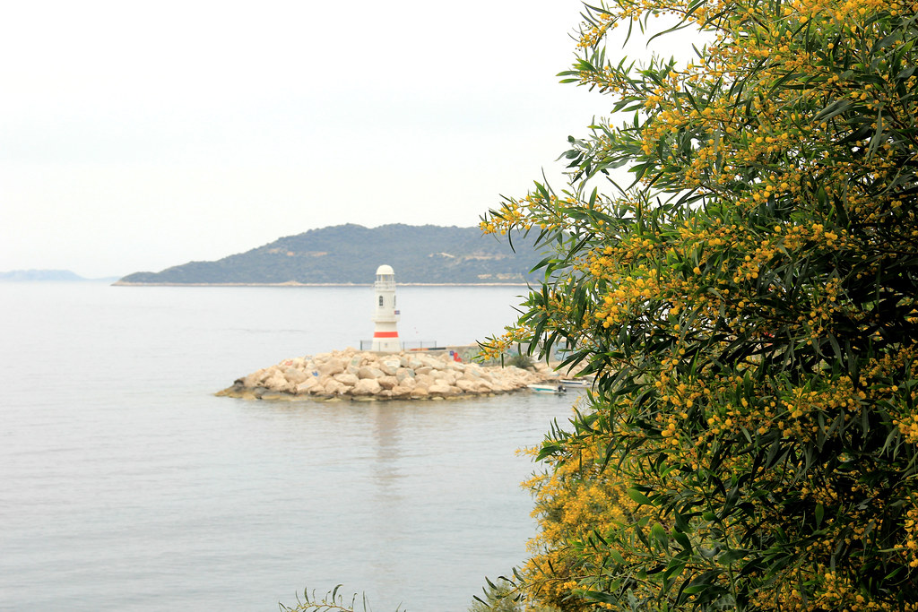
The first stop on our little boat trip was the pretty little fishing village of Üçağız.
Üçağız (meaning ‘three mouths’ due to the three openings the village has to the Mediterranean sea) is part of the Kekova Region and has therefore been a Specially Protected Area since 1990. This limits the development and building work permitted to take place there, which means that the village retains much of its authentic, rural charm.
We had a brief little wander through the village, including a peek inside a rug shop, where I think the vendors were grateful for having someone to talk to other than each other! However, it didn’t stop them attempting the sales pitch when we started touching a few of the rugs we particularly liked, and informing us that they could ship to the UK if we didn’t have room in our backpacks (which, considering that we were travelling with just 20 and 30-litre packs respectively, clearly we didn’t!)

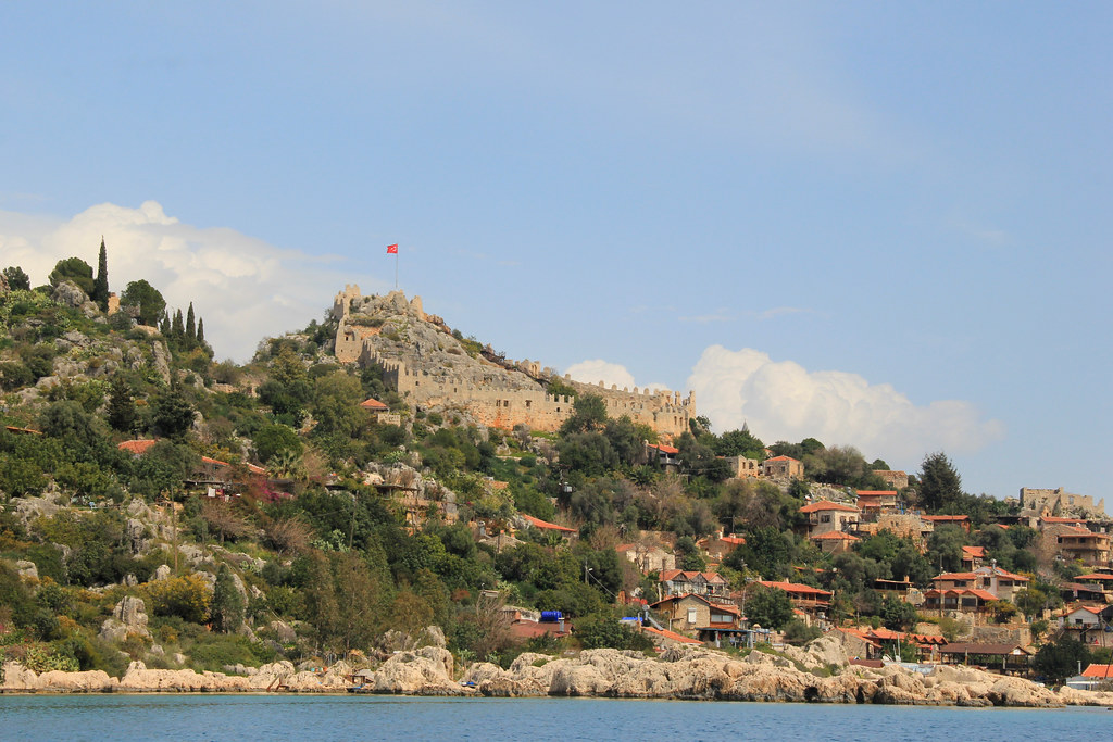
We continued on a short distance to Simena, where our captain made a second stop so that we could climb up to the village’s crowning glory — its castle.
Due to the steepness of the hill upon which the castle is located, the climb will take you on a bit of a meander through the village — along narrow lanes, up ancient stone staircases, and past an endearing collection of mismatched houses that seem to cling to the edge of the hillside.

There’s a small entrance fee to the castle, but the views more than make up for this.

After leaving Simena, it occurred to us that we’d not stopped at the Sunken City of Kekova.
As Kekova can only be accessed by boat, this was one of the main reasons we wanted to take a boat trip in the first place. We attempted to query this with our captain, but the language barrier quickly put a stop to that; he thought we wanted to go for a swim and subsequently stopped at the entrance to a cave!
We later discovered that we would have, in fact, passed right over the top of Kekova on our way into Simena’s tiny little harbour. Our captain had failed to point it out, and we’d probably been way too busy snapping photographs of Simena’s castle, as we caught our first glimpse of it perched on the top of a steep hill overlooking Kekova Island.
Our boat trip finished in Demre, where a taxi driver was waiting for us to take us up to the Myra ruins (also organised for us by the Purple House in Aperlai).
If you’re hiking the Lycian Way between Kapakli and Demre (regardless of whether you follow the main trail or the alternative route), you’ll need to take a small diversion off the path to reach these ruins. It’s definitely a worthwhile diversion, though, and allow yourself approximately an hour there.


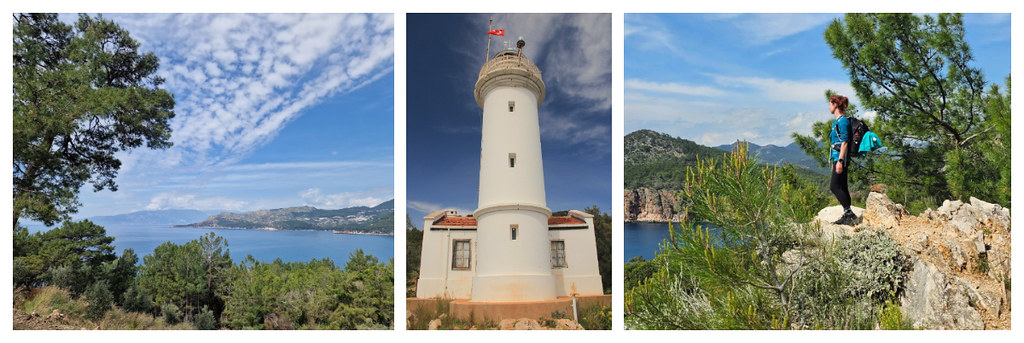
Day Eight | Karaöz to Gelidonya Lighthouse and back – 16.42 kilometres (10.2 miles)
Recorded distance walked on Strava: 16.90km | Elevation gain: 444m | Time: 3h 42m
The section between Demre and Finke is a three-day mountainous section with no accommodation options available (even wild camping is tricky due to the lack of water sources), so we had no option but to skip that segment. And the following stretch, between Finke and Karaöz is, according to Trekopedia:
“arguably the most boring, uninteresting part of the Lycian Way.”
For these reasons, our intention was to catch a bus/dolmus to Karaöz, and to walk the path from there to Adrasan (20.4km/12.7 miles). However, Jayne wasn’t sure her knee would cope with the distance or, more importantly, the descent from the lighthouse to Adrasan, which is over rocky, unstable terrain that requires extreme diligence at watching your footing. Considering that Jayne couldn’t really put much weight on her bad knee, attempting the second part of this section was simply too risky.
So, our only option was to do an out and back to Gelidonya Lighthouse from Karaöz. Logistically, this was not the simplest of tasks!
According to the hand-written bus timetable at Demre’s otogari (bus station), buses from here either go west to Kaş or east to Antalya, along the D400. When we got on the bus, we were told we needed to change buses at Kumluca. That part was easy enough, as the bus driver told us exactly where to get off and a connecting bus showed up within minutes. However, the connecting bus only went as far as Mavikent. This would have been fine, had a bus to Karaöz arrived shortly after we were dropped off. But, the next bus leaving for Karaöz was over two hours after we arrived!!
If we’d waited for the bus, we would not have had time to complete our planned walk and get to Adrasan afterwards (where we had accommodation booked that evening). So, more than a little panicked, we headed into the mini market opposite the bus stop and asked the staff if they could arrange a taxi for us. Fortunately, they understood enough English to help us. But, contrary to what we’d read online prior to our trip, taxis in Turkey are not cheap. They’re not expensive either, but relying on taxis was eating into the small stash of cash we had on us until we arrived somewhere that had an ATM available.
As luck would have it, there was a cafe on the beach at Karaöz, so we were able to grab an extremely late breakfast of a couple of bananas and some coffee. The staff there were kind enough to let Jayne stash her pack there, so that she could hike with just her phone and bottle of water. What’s more, they arranged for a friend of theirs to drive us to Adrasan when we got back, for the fraction of the price of a taxi.
But, on to the hike itself…
Whilst I’d have much preferred to not be doing an out and back hike (those sorts of walks are never my favourites), I actually really enjoyed this section of the trail. The views out to sea are stunning and, for the most part, the path follows wide, sweeping rural roads, with just the final climb up to the lighthouse being along narrow, rocky, forest tracks.


We also picked up a dog friend part the way along the trail and spotted a few tortoises, too.

If you’re walking the whole of this section all the way to Adrasan (which we would have done had Jayne not been injured), make sure you’ve got plenty of water and snacks with you; between Karaöz and Gelidonya Lighthouse, we only passed one roadside cafe, and the second section is reportedly much more remote.

When we arrived in Adrasan, we were really looking forward to a sit down and a substantial meal. Due to not being able to find anywhere open serving food in Demre before we caught the bus at 9 a.m., and then getting rather concerned about running out of cash to facilitate our onward journey, we’d survived on a couple of bananas and an energy bar each all day.
However, as you’ll already be aware if you read the accommodation section of this post, things didn’t really work out as planned! We were very grateful to have found Ademin Yeri Black House open and serving food. So, we were able to relax and refuel whilst we attempted to get hold of the owners of the guest house at which we had a booking. Ademin Yeri has a pretty riverside location, and we loved listening to the frog and duck chorus as we ate.
Day Nine | Adrasan to Çıralı – 15.5 kilometres (9.6 miles)
Recorded distance walked on Strava: 12.45km | Elevation gain: 608m | Time: 3h 53m (however, my watch stopped recording at the Olympos ruins so this is not 100% accurate)
We started the day with an amazing breakfast spread, courtesy of our host at Duran Pansiyon.
Fortunately, today did not involve the logistics of the Lycian Way’s wonderful public transportation, as we were walking all the way from our guest house in Adrasan to our guest house in Çıralı.
There are two options for hiking the Lycian Way between Adrasan and Çıralı — the main route, which consists of climbing (fairly steeply) up, over, and down a single mountain, or the alternative route, via rural roads through the valley.
We were all set up to walk the alternative route (for obvious knee injury reasons). We’d even talked ourselves into thinking that it might be quite nice to walk through some traditional hamlets and villages; we’d be able to interact with residents and experience a real sense of local life that would be absent on the mountain trails.
However, at eleventh hour, as we approached the fork where the trail splits, Jayne said “fuck it!” and took the mountain route. I guess she figured that this was our final day of walking, so it didn’t matter as much if she broke herself today — she could always rest when she got home.
I would like to point out that this is not the course of action I’d personally recommend if you get injured. It is simply the one Jayne chose. And, fortunately, it turned out to be one that didn’t come with any disastrous consequences.
The initial part of the walk takes you through Adrasan village (which is separate from the little ‘hub’ of guest houses that has popped up along the beach) and along the river. There are a few river crossings along this section of the Lycian Way so, if you haven’t got good balance and you don’t want to get your feet wet, make sure you remove your boots and socks!
Once you’ve made your first river crossing, make sure you don’t miss the right-hand turn just after. Unfortunately, we did, but a helpful local called after us and pointed us in the right direction.

You’ll pass a few greenhouses on your left-hand side and walk through a tunnel in the rock before heading into the forest and beginning your mountain climb.
The mountain climb that seems to go on forever.
Whilst we caught glimpses of some beautiful mountain views through the trees as we made our ascent, we didn’t get a full unobstructed view of the surrounding countryside until we’d completed our climb. It was at that point we realised just how high up we were.

We made a brief lunch stop to appreciate the view and photograph a few of the hundreds of wild flowers growing up there before starting our equally gruelling descent.
Again, it wasn’t the steepness of the slope, but the relentless nature of the descent, and the fact that both the terrain and environment remain unchanged for miles on end. Rocky forest trails interspersed with the odd fallen down tree to clamber over are the order of the day here, and this doesn’t really change until you arrive at the ruins of Olympos.

However, before we could explore the Olympos ruins, we had to actually figure out how to get to them. The track has been re-routed immediately south of the ruins (although it’s not obvious as to why and the original route looks to have been a much more direct one), but the alternative route is not at all obvious and we probably wasted a good half an hour here attempting to find the right path — which, incidentally, involves scrambling through some bushes and then sliding down a very steep incline of loose rocks. Helpfully, the Footpath app has now been updated to show an information symbol just ahead of this junction, stating:
“Don’t go down here: FENCE.”
So, if you keep a close eye on this, you can figure out where exactly you’re meant to take a left turn. Bear in mind though that it doesn’t look like a path until you reach the bottom of the incline.
We then had to overcome the issue of the gates to Olympos being shut when we arrived because it was after 5 p.m. We had a brief panic that, although the Lycian Way runs through the ruins, the trail may not be a permissive path outside of the site’s opening hours.
Fortunately though, we needn’t have worried — we were able to find an unlocked gate, and subsequently explored the ruins for the next hour without paying the 250TL entrance fee and without seeing many other tourists either! If you’re not bothered about having a thorough look around the site, then I’d totally recommend visiting at this time of day.

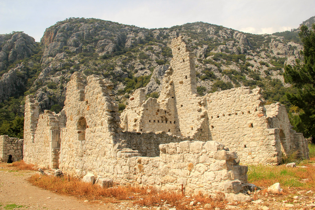
Named after the nearby Mount Olympos (Tahtalı Dağı), this ancient site was once an important Lycian city before it fell victim to piracy and was subsequently conquered by the Romans, Venetians, Genovese, and Ottomans.
The main structures here include an amphitheatre, temple gate, necropolis, sarcophagus, bathhouse, church, and basilica, and you’ll find them scattered across both sides of the river Göksu. Although, it’s worth noting that some are in such a bad state of disrepair that it’s difficult to envisage them in their former glory.
Where the river and ruins meet the sea, the Lycian Way continues across a pebble beach to reach the village of Çıralı. We were keen to get to our guest house in order to grab a shower and put our feet up. But, we stumbled upon The Beaver Coffee Shop along the way and couldn’t resist stopping for a decent brew — the first proper coffee we’d had since we left England.

Day Ten | An unhurried wander around the Olympos ruins followed by a bus to Antalya
The original plan, before Jayne got injured, was to walk the 12.6-kilometre (7.8 mile) section between Beycik and Yayla Kuzdere. This stretch is reportedly a beautiful mountain section that passes near to the peak of Tahtalı Dağı, which is the highpoint of the entire Lycian Way. We’d also read that there is a cable car station at the peak, from where you can ride a cable car down to the coast. It’s actually one of the longest cable car journeys in the world.
However, when we were doing our research, there were elements of the logistics that we could not confirm at the time (such as how we’d get to Beycik, whether the cable car would be running in March, and the availability of transportation from Kemer to Antalya), so we were open to changing these plans if we could not get the logistics to work when we were on the ground. There was also the potential for snow up on the mountain due to the time of year that we were hiking the Lycian Way, which could have been dangerous considering neither of us had hiking poles.
Once Jayne had chosen to walk the mountain route between Adrasan and Çıralı the day before, she’d made it clear that was to be her last day of walking, and I was absolutely fine with that, especially considering that our options for short and flattish sections beyond Çıralı were somewhat limited.
So, we then had to decide whether we wanted to spend our last day in Turkey exploring Antalya, re-visiting the Olympos ruins, or something else entirely.
Bearing in mind that ‘something else entirely’ may have involved a repeat of the logistical nightmare we’d experienced when attempting to get from Demre to Karaöz, and considering our aversion to crowds, we opted to re-visit the ruins of Olympos. We’d had a rather rushed visit the evening before on very tired legs, so we felt as though there was more to be explored. We also quite liked Çıralı, so the idea of lingering a little longer in this laid-back coastal village appealed to us.
If I were to do this trip again, I think I would’ve spent my last day of hiking the Lycian Way walking the alternative path between Çıralı and Tekirova. This route wasn’t really on my radar before I left England, but I’ve since found some detailed information about it on the Trekopedia website, and it sounds like a lovely (albeit fairly long) section that hugs the coast the entire way and affords some beautiful coastal views.
Because it begins in Çıralı, it also means that you wouldn’t have to worry about the logistics of getting to the trailhead. And Tekirova is a large enough resort to make finding food and drink at the end of your hike a relatively easy task. There is also a regular bus service between Tekirova (location of bus stop on Google Maps here) and Antalya, with a journey time of one and a half hours.
We spent a good two to three hours at the Olympos ruins this time around, and we were pleasantly surprised to find that we were only charged an entrance fee of 90 TL rather than the advertised 250 TL at the main gates the day beforehand.
We gave ourselves just enough time to grab our backpacks from Alican Pension before heading up to the dolmus stop in order to make the advertised 13:00 hours departure. We’d then catch a connecting bus to Antalya from the main highway, the D400.
However, what the sign at Çıralı’s dolmus stop doesn’t tell you is that the advertised dolmus only run during the summer months. Fortunately, the locals have inside knowledge that isn’t published on said sign, and they’d seen us waiting and alerted us to this fact.

The problem we then had is that we were rapidly running out of cash again. We had enough to cover our bus fares, but little else. What this meant was that we could not afford the fare for a taxi up to the main highway and we really didn’t fancy walking the 6.3 miles all uphill. Our only remaining option was to hitch a ride.
Now, I’d not hitch-hiked since I was on one of the little Japanese islands surrounding Okinawa, long before I started this blog. We had a really positive experience then, but hitch-hiking is still something that makes me feel scared, awkward and embarrassed. On top of that, we’d not really seen a lot of passing traffic as we stood on the road outside Çıralı’s mini-market.
We found a straight section of the road, with space for a car to pull into the side of the road safely, and stuck our thumbs out every time we saw a vehicle heading out of town. Nobody even so much as slowed down for us. After what felt like forever (but was probably only 15 minutes), we were ready to give up hope. But then, a campervan pulled over. I’d rehearsed the Turkish for ‘main highway,’ so that’s what I said, with a hint of desperation in my voice, as a lady wound down the window.
She looked confused and clearly didn’t understand what I’d just asked her. So, I tried again in English. It was then that it materialised that the couple sat in the campervan were, in fact, German. They were in the middle of a year-long European road trip. The woman jumped in the back in order to give up the bench seat in the front next to her boyfriend/husband for Jayne and I to sit in.
It was so lovely to be able to have a conversation in our native language with this couple as they drove us up the windy road to Çıralı’s main highway, and to hear all about their adventures thus far. It made me long for long-term travel once again. The three months I spent in Peru and two months I spent in Bolivia back in 2014 seem very far away now!
And, aside from some confusion about which bus we caught from Antalya’s main bus station to the city’s downtown area and where to catch it from, our onward journey passed without incident.
We had a brief wander through Antalya’s bazaar and grabbed a bite to eat from an overpriced restaurant down by the harbour, where we celebrated making it to the end of our 10-day adventure hiking the Lycian Way.

Hiking the Lycian Way | Final Thoughts
If you’ve made it this far, firstly I’d just like to congratulate you! Although I never intended it to be, this is easily the longest post I’ve ever written (11307 words, as I type this now!).
I contemplated breaking this guide to hiking the Lycian Way down into several different posts, but in the end I decided I wanted the continuity of having all the information to hand in one place. I hope that this (rather long!) post has provided you with all the necessary details, advice and recommendations you need to help you plan a similar trip. But, please drop me a note in the comments if there’s anything else you’d like to know.
I have a few final thoughts I’d like to share:
- Although I enjoyed doing so myself and would 100% recommend hiking the Lycian Way early in the season (March/April), do be prepared for a slightly more intrepid adventure compared to walking the trail closer to the summer months. Many of the dolmuses won’t be running and some of the cafés and restaurants along the trail may not yet have re-opened their doors. BUT, accommodation prices will be lower, there will be fewer people hiking the Lycian Way, and the weather will be a more manageable temperature for walking.
- Just like I experienced when I travelled to Jordan last September, cash is King here in Turkey. A lot of the small, family-run pensions won’t have the facility to take card payments, and many of the cafés and shops along the trail won’t either. And then, of course, there are bus and taxi fares, which also need to be paid in cash. In fact, there were very few places along the Lycian Way that we could actually use our cards for payment, and very few ATMs too. Even though we travel with debit cards which don’t charge foreign transaction fees, every single one of the ATMs we withdrew money from charged us a fee. And this fee was the same regardless of whether we wanted £20 or £200. So, my advice would be to carry as much cash as you feel safe travelling with. And, make sure you don’t stash it all in the same place.
- If your mobile phone contract doesn’t offer you a decent roaming package in Turkey (I’m on Vodafone and could use my texts/calls/data from my UK tariff up to 25GB – which is more than enough for 10 days), get yourself an e-sim, because actual sim cards in Turkey are incredibly expensive compared to other countries I’ve bought one in.
If reading about my experience of hiking the Lycian Way has piqued your interest to explore more of Turkey, check out the posts below that I’ve written about Istanbul, Cappadocia and Pamukkale.
A 10-day Turkey Itinerary: Istanbul, Pamukkale and Cappadocia
Exploring the Strange and Surreal Valleys of Cappadocia
Things to Do in Istanbul: A Few Items to Add to Your Istanbul Itinerary
Pamukkale: Bizarre Landscapes and Ancient Ruins
Cappadocia: A Balloon Flight Over a Surreal, Volcanic Landscape
A Spontaneous Paragliding Experience in Pamukkale, Turkey
If you enjoyed this post about hiking the Lycian Way, why not pin it to one of your Pinterest boards for reference?


7 Comments
Wow! Thanks for this super detailed article. So helpful. And so nice to see a different side of Turkey. Would love to do that hike some day.
What an awesome hike! The Lycian Way looks really diverse with loads to see on the way.
Love the hike. Kiara keep sharing amazing piece of content
I don’t usually leave comments on blogs but after doing a lot of research (incl. skimming many other blogs that came up in my google search), I just wanted to say thank you so much for taking the time to write such a detailed post. It was a treasure trove of information and has made me excited to try out (portions of) this hike in the fall!
Thank you so much for your kind comments Shannon 😊 It’s lovely to hear that the hours and hours of work I put into researching and writing blog posts is appreciated and valued. And thank you for taking the time to read it all – I’m well aware that it was a VERY long post! (possibly the longest I’ve ever written!) I hope you enjoy walking the Lycian Way as much as I did 🙂
Happy to stumble on to your detailed blog on the Lycian Way. I’ve planned several treks in Europe but plotting my own 10-day route on the Likya Yolu has proved to be quite a challenge, i.e. avoiding long miles, arduous climbs, cliff edges, etc all while trying to see as much as I can in a condensed amount of time. Your route encompasses everything I want to see between Fethiye and Cirali. I’d be interested in knowing what your original route was before you adjusted to the ‘lighter’ version. My partner had knee issues a few years ago on a 10 day hut-to-hut in Austria and we had to abandon that route on Day 2. Still had a great trip doing things we wouldn’t otherwise have had time for:)
Yes, it’s definitely not an easy task, is it! We spent so many hours with our heads in our laptops, desperately trying to sort out an achievable itinerary prior to our trip. In answer to your question about our original itinerary, it was as follows:
Day 1: Fethiye to Ovaçik (Ölüdeniz)
Day 2: Ovaçik to Kabak
Day 3: Kabak to Bel
Day 4: Bel to Patara West (Pydnai Ruins), dolmus to Kalkan
Day 5: Kalkan to Saribelan, taxi/dolmus to the junction south-west of Pinabarsi (for the Phellos ruins) and continue on foot down to Kaş.
Day 6: Rest day in Kas, boat trip to see the Sunken City of Kekova.
Day 7: Dolmus/taxi to Üçağız, walk to Demre, via the Myra ruins.
Day 8: bus/dolmus to Karaöz, walk to Adrasan.
Day 9: Adrasan to Cirali
Day 10: We left this one a bit open subject to info we could find out once on the ground. Either walk the 12.6-kilometre (7.8 mile) section between Beycik and Yayla Kuzdere or the alternative path between Çıralı and Tekirova. And then a bus to Antalya in order to catch our flight home the next day.
Hope that helps! And thanks ever so much for stopping by 🙂