

Fancy completing one of the most famous walks in Cheshire? The Sandstone Trail is an easy two-day hike through some of Cheshire’s most spectacular scenery.
Some of the links in this post are affiliate links. All this means is that if you make a purchase through one of the links I have provided, I will earn a small commission as a result but the cost to you will remain exactly the same.
Ever since the UK entered a full lockdown in March 2020 and international travel suddenly became a lot more challenging, I’ve been doing my best to embrace all that the UK has to offer — with the possible exception of our unpredictable weather and over-priced accommodation!
And one of the best ways to explore the UK is on foot. We’ve got 2500 miles (4000 kilometres) of National Trails in England and Wales alone, as well as hundreds of other long-distance paths (those that will generally take more than one day’s walking to complete) to explore.
However, if you’re not hardcore enough to carry all your camping gear, accommodation costs along the trail can add up — especially considering that our trails criss-cross plenty of rural (and sometimes very remote) areas with limited lodging options.
The solution?
A nice little two-day trail where you’ll only need to carry as much as you’ll require for an overnight stay.
If you’re new to walking, you’ll also be pleased to know that Cheshire’s Sandstone Trail is a relatively easy, well-signposted route that offers a variety of terrain and some wonderful views, too — especially along the middle and latter parts of the walk.
So, without further ado, let’s dive into one of the most famous walks in Cheshire in a bit more detail.
Walks in Cheshire | A little bit about the Sandstone Trail
The Sandstone Trail runs roughly north to south through the county of Cheshire, in the northwest of England. Starting in Frodsham (approximately 11 miles northeast of Chester), the trail follows the elevated ridge of sandstone hills — that rise dramatically above the Cheshire Plain — for 34 miles/54 kilometres, finishing in Whitchurch, Shropshire (just two miles south of the Cheshire border).

Founded in the early 1970s by Cheshire County Council’s Countryside and Recreation Department, and officially opened in 1974, the Sandstone Trail was one of the earliest middle-distance ways in Britain. Originally it only ran for 16 miles/25 kilometres from Delamere to Duckington, but the route proved so popular that it has now been extended twice — most recently in the late 1990s.
There are a few short, steep sections (at Frodsham, Beeston Castle, Higher Burwardsley, Rawhead and Bickerton), but for the most part I’d grade this walk as easy/leisurely, so it’s a fantastic trail to enjoy as a family, too! The fact that there’s an impressive castle to explore in the middle of the route should be incentive enough for those kids who may be dragging their heels about the whole walking idea. It’s a big part of what sold it to me 😉
The Sandstone Trail | Logistics
Both Frodsham and Whitchurch have their own train stations, which makes both the start and end points of the Sandstone Trail immediately accessible.
If you’re not as local as Jayne and I are (we live in Shrewsbury, 45 miles from Frodsham), there is plenty of accommodation in Chester, just 15 minutes away by train. So, you can enjoy the delights of one of England’s most historic cities before you start your walk.

It’s possible to complete the walk over a number of different days, depending on what sort of distances you feel capable of covering each day. We opted for two days, and this is the itinerary I’ll cover in this post. However, Cheshire West and Chester Council’s Sandstone Trail booklet splits the trail into three roughly equal parts of around 11 miles/18 kilometres per day. Alternatively, the official guidebook, Walking Cheshire’s Sandstone Trail, breaks the route into seven easy sections which start and finish at convenient towns, villages, roads or landmarks. If you’d like to have a look at these sections before buying the book, you can head over to the Sandstone Trail website, where you’ll find lots of useful information to help you plan your walk.
If, like us, you choose to complete the walk in two days, you’ll find that accommodation options en route are rather limited, especially if you want both days to be of similar distance and you don’t want to be too far from the trail. We considered staying in Tarporley, but this would have meant we wouldn’t reach Beeston Castle until day two. Beeston Castle doesn’t open until 10 a.m., so — assuming we’d spend an hour or two there — we ‘d then have approximately 17 miles to walk in an afternoon!
Instead, we chose to stay in Upper Burwardsley, at the highly-rated Pheasant Inn. Granted, we’d have no option but to eat our evening meal there, at their ‘not cheap’ attached restaurant (The Pheasant Inn is a long way from civilisation!), but it made the logistics of our two-day walk much, much easier.
We’d be covering 19.5 miles on day one and 14.5 on day two (not including the one-mile diversion from the trail to Upper Burwardsley and back). Considering we’d managed 25 miles in a day back in our home county of Shropshire, and still arrived at the end of the trail for around 5:30 p.m., we felt sure that 8:30 a.m. was an early enough start to allow us an hour or so at Beeston Castle and still make it to The Pheasant Inn in time for our 7:30 p.m. dinner booking.
How wrong we were! But I’ll spare you the details until later in this post.
The Sandstone Trail | What to Pack
It goes without saying that this is very dependent on the time of year that you choose to walk this trail. Due to the long days, I would advise against doing so in wintertime (November through to the end of March, before the clocks go forward), when the hours of daylight are greatly reduced.
Weather-wise, although it’s not unusual to score some lovely crisp and sunny days in autumn and winter, the weather is generally more unreliable through the winter months, and comes with a much higher chance of rain. They do say there’s no such thing as bad weather; only a poor choice of clothing. And I do agree — to an extent. Cold temperatures don’t bother me — I just wear more layers, and it’s a good excuse to don one of my many woolly hats — but persistent wind and rain does. So, I know I’ll generally get more enjoyment from a walk if I plan it for Britain’s spring and summer months. That said, September is usually a pretty nice month for hiking in the UK, too.

Jayne and I chose to walk the Sandstone Trail towards the end of August — the same sort of time we’d walked Hadrian’s Wall the year before. The days were still mild, but the temperatures were starting to drop a little at night.
Here’s a few of the things I’d recommend wearing/bringing with you:
- A worn-in pair of hiking shoes or boots. Either will suffice, as the terrain is not particularly challenging, but boots will offer better ankle support. I’m a huge fan of Keen hiking boots. I find they offer a great mix of style and comfort, and the ones I have are waterproof too.
- A comfortable day pack. I have a 20-litre Osprey Tempest and had plenty of room in it, even in spite of carrying my bulky DSLR camera.
- Hiking trousers or leggings. The weather was actually warm enough to have ditched our full-length leggings for shorts, but unless you’re a bit of a masochist who fancies getting stung by nettles or scratched by brambles, I wouldn’t recommend it. Your legs will thank you for it. My favourite leggings (that I use for running and hiking) are made by Sweaty Betty. They do a 7/8 (three quarter) length which are perfect for my diminutive height (I’m 5’1), and which have a pocket on the leg to carry your mobile phone in. They also fit incredibly well, have loads of stretch in them and come in lots of funky, colourful designs.
- Layers. We generally started the day in a lightweight, quick-drying t-shirt with a zip-through fleece over the top, and then discarded the outer layer when we got too warm. You may want to bring a fresh base layer for the next day, but I wore the same outer fleece for both days.
- A waterproof jacket and some waterproof over-trousers. If you’re familiar with hiking in Britain, you’ll know that it can rain anytime – even in summer. Hopefully you won’t need either of these items but they don’t take up a lot of room or weight in your backpack, so it would be stupid not to pack them. I need to buy a decent pair of over-trousers (at the moment I have kids ones because all the adult ones were way too long, but they’re not a fantastic fit), but I’ve got two decent waterproof jackets —the Rab Downpour jacket and Arc’teryx Beta LT.
- A warm, but packable jacket. These are fab to throw on to give you that little extra bit of warmth. I love my Rab Alpine Microlight jacket.
- Sunglasses. I forgot mine and I was kicking myself when the sun came out on the second day.
- A refillable water bottle and some snacks. There aren’t many places to buy food and drink actually on the trail itself, so make sure you pack as much food and drink as you’ll need between breakfast and dinner.
- Comfortable walking socks. Bridgedale make some great ones, as do Smartwool.
Walks in Cheshire | Day One on the Sandstone Trail
Ordinarily, we’d have been able to catch a train to Frodsham station. But, seeing as though we’d decided to start walking the trail on a Sunday (it was the only day we could secure a less expensive room at the Pheasant Inn, and meant that we only had to book one day off work rather than two), and the trains don’t begin their schedules quite as early on a Sunday morning, we managed to rope Stu into giving us a lift to Frodsham instead.
A small sandstone and steel obelisk outside the Bear’s Paw pub marks the official start point of the trail. If you’re arriving by train, it’s just a two-minute walk from the train station to the Bear’s Paw.
We were hoping to pick up a coffee before we set off, but there’s not a lot happening in Frodsham at 8 a.m. on a Sunday. So, in spite of walking past a Costa and a number of smaller independent cafes and coffee shops along Church Road — all of which were closed — the first sign of life we spotted was a dog walker and his faithful hound, as we headed out of the village and took a right off Bellamonte Road. As dogwalkers do, he stopped to talk to us while we were jettisoning a layer or two. It had been a steady uphill climb since leaving the pub.
Being local to the area, he’d walked parts of the trail himself, and listening to him talk about his experiences only served to increase our own excitement about finally being able to tick one of the most well-known walks in Cheshire off our hiking list.
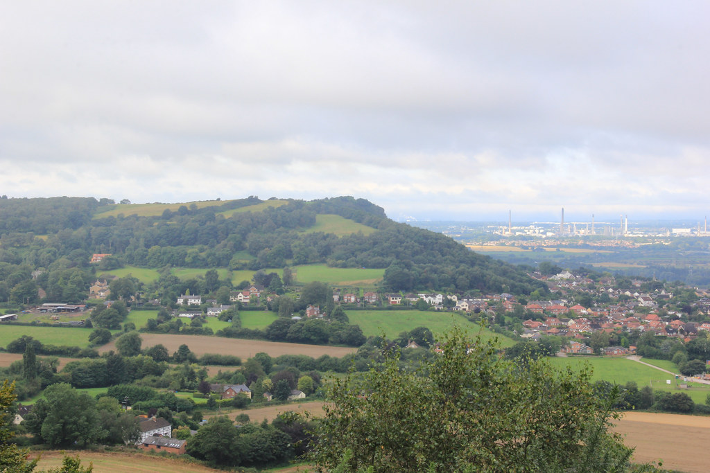
We said our goodbyes and he wished us well as we continued on our journey. The path took us towards the foot of the densely wooded slopes of Overton Hill, and along a steep, signposted path that zigzags its way up through mature woodland, tree roots creeping across the ground beneath your feet.

In fact, much of the initial part of Cheshire’s Sandstone Trail sees you walking through various different woods that all start to blend into one after a while. I mean, don’t get me wrong, I love trees, but I must admit that we did find ourselves longing for a landscape slightly less arboreal to feast our eyes upon.
The exception, of course, is the moment you emerge on to the top of Overton Hill, by the Frodsham War Memorial. The incredible panoramic view encompasses Liverpool’s distinctive skyline in the distance, along with the watery expanse of the Mersey Estuary. Liverpool makes for a fantastic little city break; you can read more here.
Just before entering Delamere Forest, you’ll arrive at Stonehouse Farm B&B and Cafe. We decided to stop here for a coffee, because it was the first establishment we’d seen serving refreshments since we started our walk almost 10 kilometres earlier. We also suspected that it may be the last for the next 10 kilometres, too. The coffee they serve here is certainly no patch on Costa (in fact, I’m not even sure it’s not instant coffee), but at the same time it will only cost you £1. You can bag yourself some eggs on toast or a sausage butty for an extra £2. Please note: Stonehouse Farm Cafe only accepts cash (correct, August 2021).
Once a medieval hunting forest of Mara and Mondrem, Delamere Forest is now the subject of a huge regeneration project catering to the 750,000 annual visitors who come here to enjoy the largest area of woodland in Cheshire. The forest covers a massive 927 hectares of land and encompasses a wealth of colour-coded circular walks, as well as a newly-built visitor centre, car parking for 500 cars, a café, toilets, and bicycle hire.
We decided against veering from the trail into Delamere’s disorientating maze of tall trees, and instead continued on towards Gresty’s Waste and Primrose Hill Wood.

Walking from one woodland to the next with seemingly no break in between was really starting to zap our enthusiasm for a walk that we were initially very excited about.
Hoping that the interestingly-named ‘Urchin’s Kitchen’ (reportedly a hidden gorge that was formed at the end of the last ice age, when glacial melt water carved a channel between the rocks) would offer us a break from the monotony of the surrounding landscapes, we were disappointed to find nothing more than an information board in the midst of yet more woodland. We later discovered that said information board simply indicates the start of the walk to Urchin’s Kitchen. It is, apparently, only a small diversion from the trail, though, and one that is well worth making.
Fortunately, not far past the sign for ‘Urchin’s Kitchen,’ the trail emerges on to open farmland, following the hedgeline uphill, before dropping down on to a winding green lane called ‘Sandy Lane.’
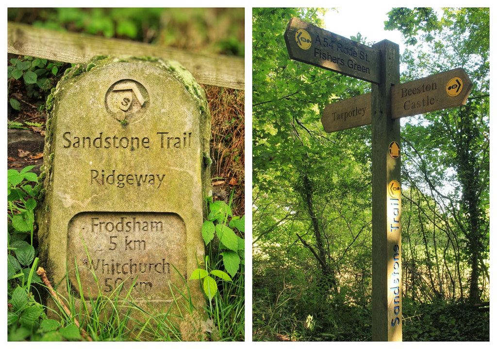
It was here that we first began to see signs for Beeston Castle, and we made the very wrong assumption that we were a lot further along the trail than we actually were. Because, you won’t find distances mentioned on any of the Sandstone Trail finger posts; the only indication you have of how far along you’ve come is from the odd milestone hiding in the undergrowth at the side of the road.
So, we were rather disappointed, when we checked the map, to find that we’d not even passed Tarporley yet, and we’d still have to make it to Wharton’s Lock before we were anywhere near Beeston Castle. So, we sat ourselves down at the edge of a field, gazing down on what we assumed to be the outskirts of Tarporley in the distance, and ate the sandwiches Jayne had made for us earlier on that morning.
The trail doesn’t directly bypass Tarporeley, but once you arrive at the junction to the ancient Back Lanes, it’s approximately a kilometre into the centre of town. If you’re breaking the trail into three, Tarporley is a great place to bed down for the night. It’s considered to be one of Cheshire’s most attractive villages and is home to both 3 and 4-star hotels, an Italian restaurant, a pub, a wine bar, a chocolate shop, and a few cafes and coffee shops to boot.
From here, you’ll continue along shady green lanes, flanked on either side by banks and ditches, around the edges of fields, across little wooden bridges over streams and alongside newly planted native woodland. When you reach Pudding Lane, with its distinctive black and white, curved top iron railings, you’re not far from crossing the Shropshire Union Canal and the River Gowy, towards Beeston Crag.

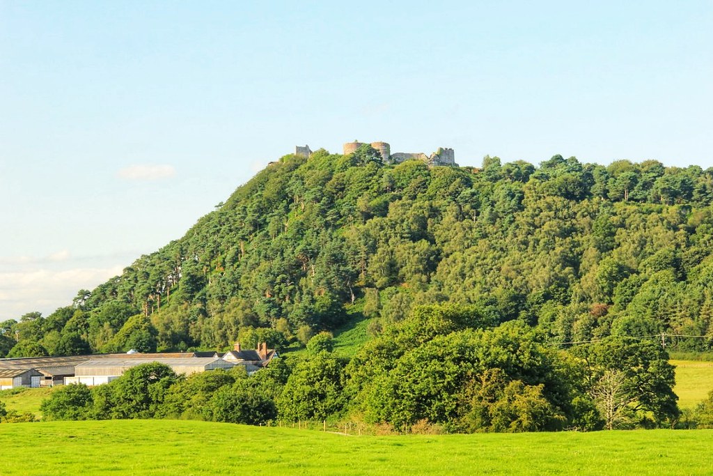
We were so overjoyed when we arrived at Wharton’s Lock, because it meant that we were finally closing in on Beeston Castle. However, along with that initial excitement came the realisation that we weren’t going to make it to the entrance of Beeston Castle until at least 4:30 p.m. Whilst an hour or so (the castle closes at 6 p.m.) would have given us just enough time to climb up to the summit and back and have a quick look around, we couldn’t have then made it to the Pheasant Inn, checked in and showered in time for our dinner reservation at 7:30 p.m. I was absolutely gutted. Beeston Castle was set to be my highlight of the whole walk.
Once I’ve made it back to Beeston Castle, I’ll include some information and photos in this post.
So, having reluctantly accepted that we’d have to return to Beeston Castle on a separate occasion, we relaxed for a while in the sunshine at Wharton Lock, watching a couple of canal boats expertly navigating their way through the lock. I’d never really given much thought before to the physics behind the operation of the locks, but it’s fascinating stuff and a strangely mesmerising process to witness.

Satisfied that we were armed with enough knowledge to pass a basic examination question on lock operation, we departed through the kissing gate and walked despondently in the direction of Beeston Castle.
Whilst the castle is not far from here as the crow flies, the trail takes you around the base of Beeston Crag, towards the car park and imposing main entrance.

Just before you arrive at the entrance, you’ll pass the attractive timber-framed Castle Gate Farm and its well-manicured gardens. We were delighted to find some ripe damsons growing on the tree outside, so we snaffled a few to tide us over until dinner.


The lane curves downhill beyond the castle entrance and not much further along, you’ll see a Sandstone Trail information board and picnic area. Take a right turn here, along a narrow path signposted to ‘Whitchurch.’ It runs alongside the castle’s encircling stone wall before veering left and dropping downhill beneath tall pines.
As you cross Tattenhall Lane and head through the next field in the direction of the wooded Peckforton Hills, you’ll catch a brief glimpse of Peckforton Castle, poking out above the treeline. Arrive at Horsley Lane and you’ll also be treated to a view back towards Beeston Castle.
As you continue along Horsley Lane, you’ll pass a number of old cottages dating back to the 16th century. My favourite was the one below — the Moathouse — because I love its half-timbered front and decorative old chimneys, and the way in which the surrounding vegetation is slowly starting to reclaim it.

As you turn off Horsley Lane on to a broad track that circuits the base of the Peckforton Hills, you’ll start to see signs pointing towards ‘Burwardsley.’ But, there’s still some distance to go yet before you reach a fork. When you do, a left-hand turn takes you uphill on a narrow track towards Bulkleley Hill (the continuation of the Sandstone Trail), but we were heading downhill, along the wider track that turns into Pennsylvania Lane and subsequently runs through the hilltop hamlet of Higher Burwardsley — the location of the Pheasant Inn.
And we honestly couldn’t have asked for a better location from which to enjoy a post hike beer. The sunsets up here are incredible!
Unfortunately, I’d left my camera in the room, so this shot was captured as we set off the following morning.

Walks in Cheshire |Day Two on the Sandstone Trail
Following a disappointingly overpriced dinner and bottle of wine the night before, we were pleasantly surprised to find a veritable feast on offer for our complimentary breakfast. We were presented with a long list of breakfast items to peruse and — contrary to Jayne’s initial assumption that we could only choose one each from said list — we were delighted to discover that we could, in fact, order EVERY SINGLE THING off the menu, had we the appetite or inclination. I ordered myself some fresh fruit and yoghurt and a croissant, followed by smoked salmon and scrambled egg on a toasted bagel. I wrapped the croissant up to have for lunch later.
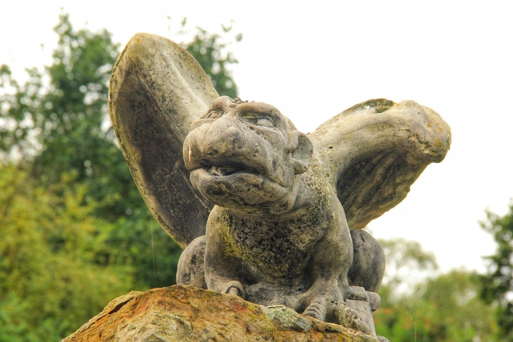
Sufficiently fed and watered, we made our way back to the trail, half a mile away, passing this interesting character en route.
The trail climbs steadily, flanked on either side by tall trees and a dense thicket of ferns, before emerging on to a more well defined trail that runs alongside woodland and criss-crosses a few roads along the way.
Pretty soon, you’ll arrive at a flight of sandstone steps leading into the National Trust’s ‘Bulkeley Woods.’

The path snakes up hill through oak, birch and rowan woodland, and then levels out and skirts the edge of the escarpment around Bulkeley Hill.
Unfortunately, you won’t get much of a view here for the most part, due to the dense vegetation growing on both sides of the trail; the views come further along, at Rawhead.

At 227 metres above sea level, Rawhead is the highest point on Cheshire’s Sandstone Trail, and your arrival here is marked by a white-painted concrete trig point and rudimentary sign engraved with faded blue paintwork.

The best views, however, come around 500 metres before you reach this trig point, at the clearing below.
At first I was annoyed that this couple and their picnic had taken residency here, because I would’ve liked to have gotten a photograph of myself on the rock, admiring the view. However, upon reflection, I think it makes quite a lovely, un-posed shot. And, in all honesty, it’s a pretty amazing spot to enjoy a picnic from.

On a clear day, the panorama includes much of south Cheshire and the Welsh hills to the west, with the Pennines to the east. And, although the weather had gotten a little hazy again by the time we arrived, we were still pretty happy with the views here.
If you like caves, there are a apparently a number of them somewhere below the Rawhead viewpoint – including the rather interestingly-named ‘Bloody Bones’ cave, which is said to have been the home of brigands (armed robbers). They’re not the easiest to find though, and because they weren’t marked on our map, we didn’t know exactly where we were meant to be looking. Let me know if you manage to locate them and whether they’re worth a visit!
Not long after you pass the trig point, the path bends right, down a long flight of sandstone and timber steps and then descends gently along the edge of sandstone cliffs to a fenced promontory topped with pines. Not much further along, you’ll be rewarded with this viewpoint, of an impressive sandstone outcrop high above the Cheshire Plains.

The trail then skirts the edge of Tower Wood and Combe Dale, hugging the field boundary beside a plantation of mature Scots pines, before heading down towards the main Nantwich to Wrexham Road and into the village of Bickerton.
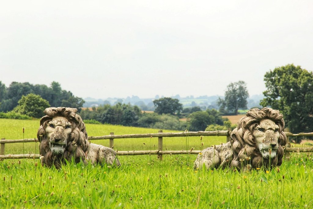
Where we saw a couple of lions in a field.
Bickerton is actually a lovely little village with a 19th century church at its core, but you’ll be leaving it shortly after you pass the old vicarage, via a pathway signposted to ‘Larkton Hill’ and ‘Whitchurch.’
This is the approach to Bickerton Hill.
Managed by the National Trust— who describe the area as “a place of wild and rugged tranquillity“— Bickerton Hill contains 300 acres of lowland heath that are now a designated Site of Special Scientific Interest (SSSI). Since they acquired the site in the 1980s, the National Trust have been working on a restoration project which includes the re-introduction of grazing, in order to prevent trees from colonising areas of open heath and to promote a mix of habitats. They also maintain the footpaths and signage for the benefit of visitors like us.

And it shows — I really enjoyed Bickerton Hill. The views are stunning and the abundance of heather (once used for thatching roofs) really helped to brighten the place up, in spite of the cloud building overhead.
I also loved the rather intriguing names of the points of interest up here. Although we didn’t manage to locate either Mad Allen’s Hole (a small cave once occupied by a hermit) or Maiden Castle (spoiler alert: it’s not an actual castle), we did walk past the memorial known as ‘Kitty’s Stone.’ Kitty was the wife of Leslie Wheeldon, and the person who helped the National Trust acquire the northern end of Bickerton Hill in 1991.

At the top of Bickerton Hill, you’ll begin your descent along a sandy track signposted for ‘Larkton Hill.’
Enjoy the views here, because when you reach the bottom of Larkton Hill, you’ll be trudging through agricultural farmland and cornfields for approximately nine kilometres.

One of the first places you’ll skirt is the enormous Manor House Stables, a thoroughbred horse racing establishment belonging to former footballer, Michael Owen, and Betfair co-founder, Andrew Black.
Racehorse trainer, Tom Dascombe, reportedly has around 100 horses in training at the stables, but we saw only two, and not a single stablehand. The place seemed eerily deserted, and — aside from the grand entrance gates—looked like it could use a little TLC.

You’ll emerge from the grounds of the farm on to Shay Lane, a wide tarmac, little used country road that you’ll relish walking along after all that lumpy farmland preceding it. Lumpy farmland is, unfortunately, the order of the day for a while longer though, as you take a left off Shay Lane, through a kissing gate signposted to ‘Bickleywood’ and ‘Whitchurch.’
Prior to doing the walk, we’d learnt that this particular area was home to grazing herds of Longhorn and Dexter cattle, and Hebridean sheep, so we were very excited when we spotted our first Longhorn cow —albeit, from a distance.

The Hebridean sheep sadly remained elusive. Or perhaps they were simply lost in the cornfields — which is exactly where we found ourselves on more than one occasion.
If you’ve ever seen the 80s horror film, ‘Children of the Corn,’ attempting to fight your way through densely-packed six-foot-tall corn plants is not an activity you’ll want to find yourself doing, and certainly not alone. It’s disorientating at the best of times.
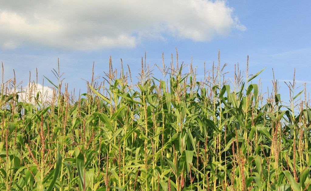
Fortunately, we didn’t meet any demonic-looking axe-wielding youths as we carved our passageway through the crops.
And finding these fruit trees in an orchard adjacent to a seemingly never ending field of wheat (or barley?) crops absolutely made our day. A few of the apples were just within reach of our eager hands, and made for a delicious and juicy little pick-me-up at exactly the point we needed it.


A few muddy fields and boggy marshland crossings later and we’d made it to the next notable landmark — the curious and somewhat isolated Old St. Chad’s Chapel, located on the edge of another (yep, you’ve guessed it) cornfield.

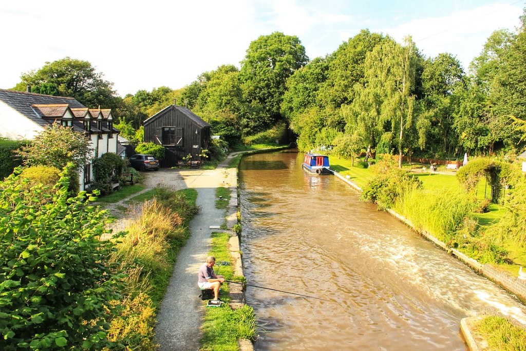
Just as we’d found with Beeston Castle the day before, it seemed that Willeymoor Lock was much further away than we’d imagined it to be. We’d been following signs towards ‘Whitchurch’ and ‘Willeymoor’ for what seemed like an eternity before we finally spotted the white-painted Willeymoor Lock Tavern on the horizon ahead of us.
We were more than ready for a sit down and a coffee, and the tavern had a lovely little beer garden overlooking the lock. So, you can imagine how gutted we were to find that the pub was closed, and didn’t re-open until 6 p.m. It had only just turned four o’clock.
But, we were grateful for a nice change of scenery along the canal towpath and we knew there was another café further along at Grindley Brook. So, we enjoyed a tranquil wander along the Llangollen Canal, passing the odd dog walker en route.

Considering that today had been a shorter day than the day before (by five miles), we didn’t seem to be doing any better time-wise. And we were absolutely shattered by the time we arrived at Grindley Brook — 10 minutes after the Lockside Café had closed its doors.
We sat down to rest our legs and eat our croissants before summoning up the energy to make the final push on to Whitchurch, nearly two miles away.
Grindley Brook is one of the most picturesque sections of the canal, as well as the meeting point of several long-distance walking trails: the Sandstone Trail, Marches Way, South Cheshire Way, Shropshire Way, and Maelor Way.

The trail officially ends at a two-metre-high sandstone archway located at the entrance of the car park at Jubilee Park. But, seeing as though this was the opposite direction to the train station, and we had almost an hour and a half to wait in Whitchurch if we missed the next train, we skirted Jubilee Park and missioned it to the train station instead.
Rushing through the streets of Whitchurch on already tired legs was not how we’d planned to finish our two-day Sandstone Trail hike, but it felt good to actually make it on to the train we’d been running for, and to be on our way back to Shrewsbury for a hot bath, some well-earned food and drink, and a long rest. Well, until the following weekend, at least 😉
Sandstone Trail | Final Thoughts
As we say about all the walks we undertake, always allow more time than you anticipate it will take you! If we’d have set off an hour earlier on day one, we’d have had time to visit Beeston Castle. If we’d have not had quite so much of a relaxed start on day two, we’d have made it to the Lockside Café at Grindley Brook before it closed. But, in a way, that’s all part of the adventure, isn’t it?
If you enjoyed this post on walking Cheshire’s Sandstone Trail, why not pin it to one of your Pinterest boards?


1 Comment
A lot of those pics reminded me of walking around the Cotswolds a little bit. We are so lucky here in the UK for our countryside, there is just a character to it that I can’t quite explain. Especially in good weather as you had by the looks of it!