

At the end of May, I swapped the rolling hills of Shropshire (where I live) for the rugged coastal scenery of North Wales. I spent an incredible three days walking part of the Wales Coast Path, along the beautiful Llyn Peninsula between Pwllheli (where I based myself) and Porth Colmon. And I couldn’t have asked for better weather for it! It was raining right up until I arrived in Pwllheli on the Monday and the rains returned again when I woke up on the Friday to head back home. But for those three days in between, the sun was shining down on me almost constantly.
What’s often put me off travelling within the UK, over hopping on a plane and heading overseas, is that the weather is so unpredictable – even through the summer months. But when you get lucky with the weather, you really couldn’t ask for anywhere better!
And because us Brits like to walk, there are an abundance of walking trails here too, in order to help you explore, and fully appreciate, our incredible landscapes.
But, before we dive into my three-day itinerary, you may want to learn a little bit about Wales’ newest National Trail.
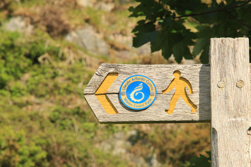
The Wales Coast Path | Information about the trail
Created in 2012, the Wales Coast Path is the longest National Trail in the country. It stretches for a massive 870 miles (1400 kilometres) between Chester in the north and Chepstow in the south, and follows, or runs close to, the coastline of Wales. In fact, it has been heralded as the first dedicated coast path in the world to cover the entire length of a country’s coastline.
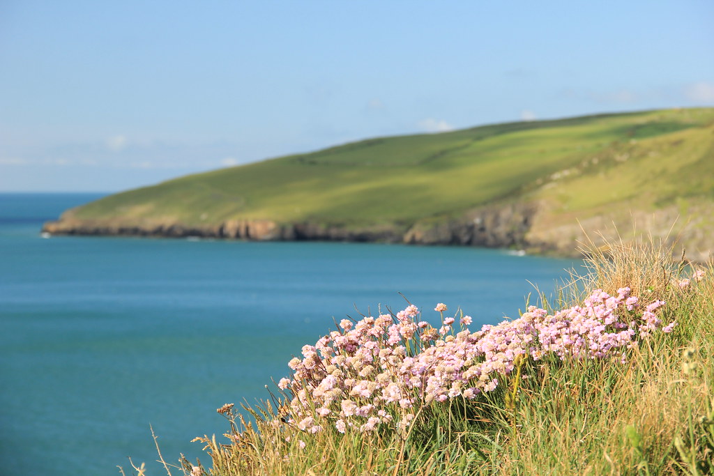
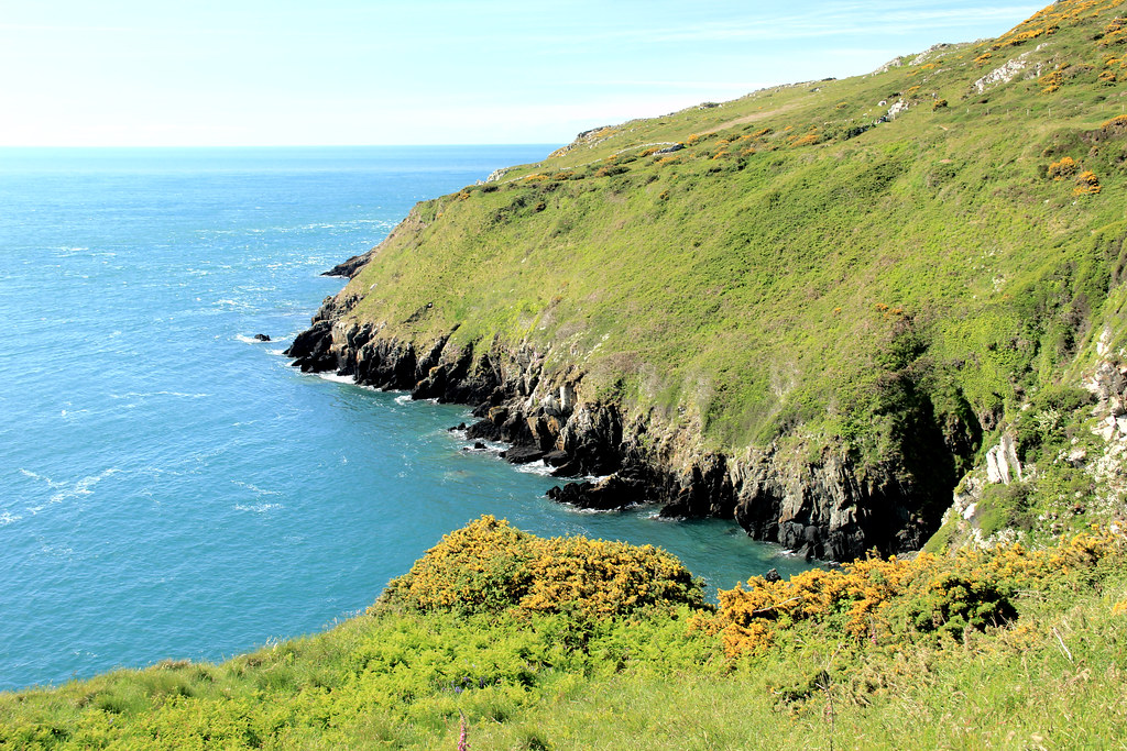
Quieter than Cornwall and less crowded than Devon, the Welsh coast is often tranquil, remote, and breathtakingly beautiful. And, as I discovered just from walking a very small section of it, much of the trail is rugged and wild, and features an abundance of natural habitats and wildlife.
Obviously, it would take a fair while to walk the entire path in one go, and in my opinion it would be insane to try it (although, one woman – Arry Beresford-Webb – reportedly ran the whole coast path before it was officially open!). However, it is a very manageable walk if you break it down into sections. You can choose to walk these sections as individual day hikes, or – as I did – you can join a few sections together to create a slightly longer multi-day hike.
The Wales Coast Path | Llyn Peninsula section
The Llyn Peninsula section runs between Caernarfon in the north and Penrhyndeudraeth (close to Porthmadog) in the south, for a total of 110 miles (180 kilometres).
My guidebook describes Llyn as,
“one of the remotest corners of Wales.”
And this is one of the major reasons that walking this section appealed to me so much.
Unfortunately, it also means that this section is the most problematic of the whole route, in terms of the transport options available to and from the start and end points of every day. There is a Llyn Peninsula coastal bus service available during the summer months, but out of season buses may only run a handful of times a week. Accommodation options are also few and far between along this stretch of the trail.
Wales Coast Path | Logistics
When you’re walking a linear trail (as opposed to a circular one), you generally have three options available with regards to the logistics, assuming you want to do it independently as opposed to joining an organised tour:
- Carry all your gear with you from point A to point B. Although, from my experience of walking Hadrian’s Wall, this takes a huge element of enjoyment out of the walk itself.
- Use a luggage transfer company to transport the majority of your luggage from point A to point B, taking just a day pack with you on the walk. This worked well for us on the Hadrian’s Wall Path. However, similar options are only available on certain parts of the Wales Coast Path, and it appears that the Llyn Peninsula is not one of them. If you do find information available on the contrary to this, please let me know!
- Choose a base from which there are good transport links to and from certain points on the trail, and catch a bus/taxi to the start point and from the end point each day.
I chose the third option on this list because I found a three-day Wales Coast Path itinerary that offered a suggested base of Pwllheli and gave me specific and up-to-date information on the buses running between there and the start and end points of each day’s walk. Originally I was heading off on this adventure alone and without any transport of my own, so this seemed like a very doable way of walking this part of the trail.
As luck would have it, Stu decided at the eleventh hour that he would join me. Stu doesn’t do walking (well, not the kind of distances I’d planned to cover), so I had my own personal taxi service available, as opposed to having to rely on public transportation. This may sound like a rather odd concept to those of you who are used to spending the majority of their time on holiday with their partner, actually in the company of their partner, but it worked well for us. We both appreciated the freedom to pursue our own passions and interests, whilst still being able to spend the evenings together, sharing stories of how we’d spent our time during the day.
It also meant that I did not have to stick to the start and end points listed on the itinerary I’d found. And, in fact, I’d read that the section just past the finish point of that itinerary, between Aberdaron and Porth Colmon, was,
“one of the most wild and awe-inspiring.”
So, I decided that, by making my days a little longer than those in that itinerary, I could actually cover the whole section, between Pwllheli and Porth Colmon, in just three days.
Every evening, before I set off the following morning, I would map the route on my Footpath app (which I highly recommend, for mapping both walking and running routes), which meant that I could follow it on my phone, to ensure that I stayed on track.
My days were set out as follows:
Day 1 | Pwllheli to Nant-y-Big Campsite (Porth Ceiriad) – 14 miles
Day 2 | Nant-y-Big Campsite to Aberdaron – 17 miles
Day 3 | Aberdaron to Porth Colmon – 13.7 miles
You can find out more about each individual section below.
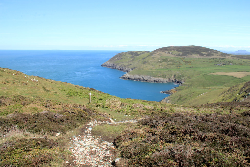
Day 1 | Walking the Llyn Peninsula from Pwllheli to Nant-y-Big Campsite (Porth Ceiriad)
Distance: 14 miles (22.5 kilometres) | Elevation gain: 418 metres
Seeing as though this was actually a holiday and I’m not much of a morning person at the best of times, I set off around 8:30 a.m. on my first day of walking the Wales Coast Path. 14 miles isn’t a massive distance compared to some of the day-hikes I’ve completed back in Shropshire (where I live), so I was confident that this would give me ample time to walk this section and enjoy a few stops along the way.

And I timed it pretty well to be honest: I took an early lunch break up at the Tin Man on Llanbedrog Head, met Stu for coffee and ice cream on Abersoch beach, and still arrived into Nant-y-Big just after 4 p.m. Footpath reckoned that just the walk alone (at an average speed of 3.2 km/hr) should have taken me 7 hours and 10 minutes.
In comparison to days two and three, day one is a relatively easy walk, with the climb up to Llanbedrog Head being the only time you’ll really need to work those calf muscles of yours.
As you leave Pwllheli, you’ll walk along The Promenade, in between sweeping sand dunes and rows of grand, pastel-hued houses. And, although your sea views disappear for a while as you pass through Pwllheli’s golf course, they do return after about a mile and pretty much stay with you for the rest of today’s walk.
But it wasn’t the sea views that initially filled me with excitement; it was the rabbits.
Over the three days I spent walking this part of the Wales Coast Path, I literally saw hundreds of the little creatures. But, my first sighting of them was on the approach to Llanbedrog. The narrow pathway was flanked with dense vegetation and gorse, and ahead of me they looked simply like large rocks scattered across the trail. As I approached, the white flash of their tails as they hopped away to safety gave away their true identity. Of course, they’re far too timid to linger around long enough for me to capture this on film, but it didn’t stop me trying!
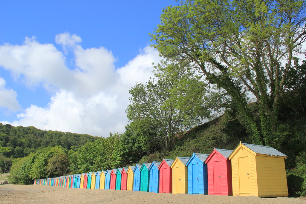
By the time I arrived at Llanbedrog beach, the sun was shining brighter than ever, and really helped to pick out the colours of these bold and beautiful beach huts. The trail takes you across the beach itself, so you’ll have ample opportunity to capture a photograph of your own.
Although the coast path does not take you into Llanbedrog itself, it does take you via Plas Glyn-y-Weddw – one of Wales’ oldest and most picturesque art venues.
When I was doing my research on the Wales Coast Path, I’d factored in a visit here for two reasons. Firstly, because I love contemporary art exhibitions and secondly, because this particular one is housed inside a spectacular Grade II listed Gothic mansion, surrounded by some equally beautiful gardens and shaded woodland trails.

In the gardens you’ll find a couple of sculptures on display, as well as the only surviving horse-drawn tram to have carried travellers between Pwllheli and Llanbedrog.

I wish I could tell you how marvellous the inside was as well, but unfortunately, on the day that I rocked up, the lady on the front desk regretfully informed me that the art gallery was closed, due to a changeover of exhibitions. Yep, impeccable timing as always! If you want to be sure that the same doesn’t happen to you when you visit, you can check out the dates of the current exhibitions on display here.
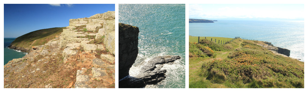
As you leave Plas Glyn-y-Weddw, the climb begins up to Llanbedrog Head. At first you’ll pass through areas of dense scrubland, with views of the hills behind you and distant views of the ocean ahead, and then the path gets more rocky underfoot as you approach the headland.
I’d actually done this part of the walk some years beforehand, when a few friends and I spent a weekend based at The Willows campsite, just outside of Abersoch. So, I felt that wonderful mix of familiarity and excitement as I neared Llanbedrog Head. And, when I reached the Tin Man sculpture, the views were just as spectacular as I remember.
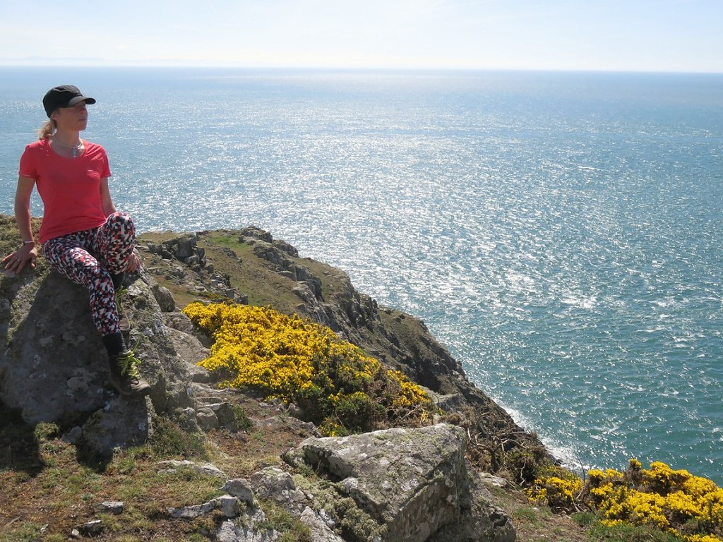
Whenever I take solo trips, I always feel rather gutted as I look through my photos after I arrive home and there are zero of me. Like that run you forgot to record on Strava, it’s almost like you didn’t go on that trip if there are no photographs to prove it! With this in mind, I packed my gorilla pod and my little compact camera (I can’t set a self timer on my DSLR without a remote control and a lot of faffing around) for this three-day adventure on the Wales Coast Path.
And, I thought that this viewpoint would be the perfect opportunity to use it. Especially considering that, apart from a couple of dog walkers near Pwllheli, I’d hardly seen a soul on the trail up until this point.
Unfortunately, the moment I arrived at said viewpoint was the moment that everyone else did, too. As soon as one group left, another arrived. I decided to take up residence on a comfortable looking rock on the headland and enjoy a spot of early lunch while I waited for a break in the pedestrian traffic. Sadly, that break never happened, so I reluctantly packed my gear away and continued on my way. I figured there would be many more opportunities further along the trail.
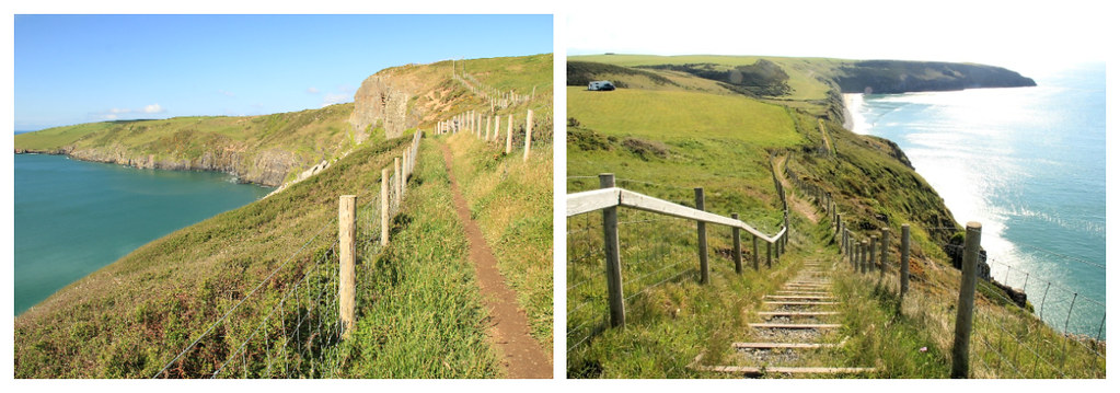
The rocky path follows the contours of the headland, staying close to the edge and giving you some fantastic views out to sea and of the beaches down below.

I was a bit disappointed when the trail began to head inland and proceeded to take me downhill rather sharply – via a series of steep manmade steps cut into the hillside – towards The Warren Beach.
This is a private stretch of beach, with public access across it, and is named after the exclusive holiday resort that overlooks it. Although all the luxury chalets here are privately owned (one sold recently for £500,000!), some are rented out as holiday homes to those who can afford the price tag. The Warren has its own spa, boat storage and helicopter landing pad!
After around one and a half miles, you’ll reach Abersoch. Once a small fishing port, Abersoch is now an attractive seaside resort with a large, relatively sheltered sandy beach that’s popular with water sports enthusiasts. The town also hosts Europe’s largest wakeboard music festival – ‘Wakestock.’
Much as I would’ve liked to have had a wander around town and taken a little nosey in some of its little boutiques and gift shops, I was on a mission to meet Stu at the opposite end of Abersoch Beach. So, I picked up the pace a little along Lon Sarn Bach and through Abersoch Golf Club in order to arrive at The Little Tearooms at Mickey’s Boatyard by 2 p.m.

The Little Tearooms is a lovely little cafe situated right on the sea front on Machroes Beach, with views of Abersoch Bay and the mountains of Snowdonia in the background. Owners, Carron and James work closely with local suppliers to provide a delicious menu of breakfast, sandwiches, salads and snacks, along with freshly baked cakes, loose leaf teas and locally-brewed Poblado coffee. I only had time for a coffee and an ice cream, but I left Stu there salivating over the food offerings!
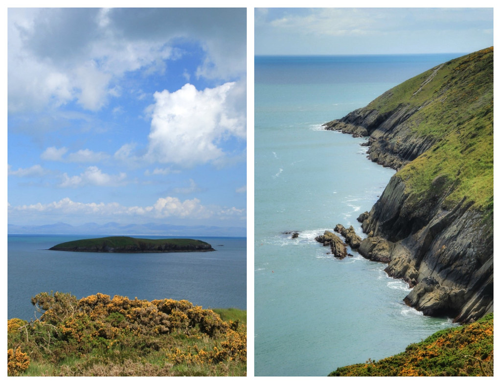
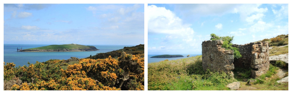
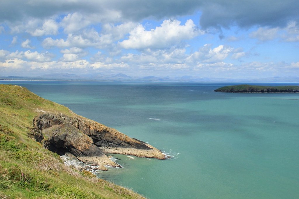
The next section of the Wales Coast Path was undoubtedly my favourite section up to this point. The trail took me back up on to the headland, from where I marvelled at the incredible views of St. Tudwal’s Islands. Clough Williams-Ellis (who built Portmeirion, which I talk about in this post) once bought the islands to protect them from development. Nowadays, the West Island is owned by adventurer Bear Grylls and the East Island by author Carla Lane.
My first day of walking the Wales Coast Path finished right after I’d rounded the Penrhhyn Du headland and arrived at Porth Ceiriad beach. My Wales Coast Path guidebook had helpfully marked all the car parks in the area on a map, so we’d been able to find one not far from the trail, close to Nant-y-Big campsite. And that was where Stu was collecting me from at the end of day one.
Of course, the beauty of having a car was that we did not have to head back to Pwllheli again for dinner; we could find somewhere en route that took our fancy. And this evening it was Glyn Y Weddw Arms in Llanbedrog, with the sole purpose of soaking up the last few rays of sunshine in their beer garden while we ate our meal.
Day 2 | Walking the Llyn Peninsula from Nant-y-Big Campsite (Porth Ceiriad) to Aberdaron
Distance: 17 miles (27.4 kilometres), but I ended up doing 20 because I got lost! | Elevation gain: 541 metres
I managed to get a rather reluctant Stu out of bed relatively early this morning, in order to drive me back to the Nant-y-Big campsite car park, so that I could start my second day on the Wales Coast Path. I was very aware that this was to be my longest day of walking, and that the route was not going to be quite as flat as the day before. The elevation gain of 541 metres was set against a loss of 602 metres, which meant A LOT of ascents and descents. In fact, the only flat section was the point at which the track headed inland.
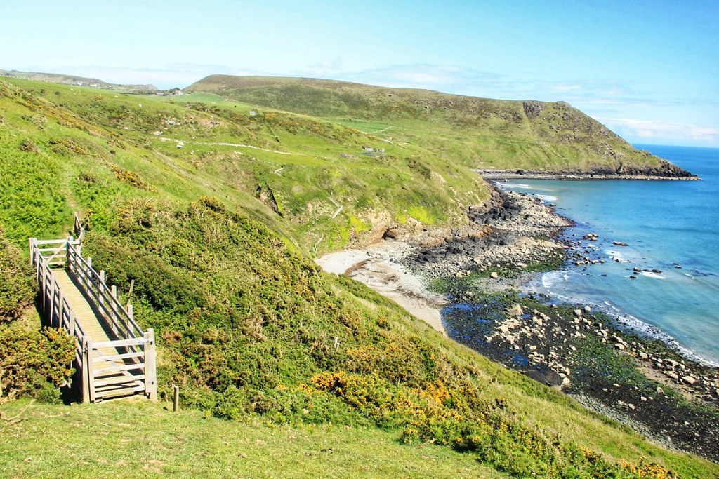
As soon as I left Nant-y-Big, I started climbing. It was a pretty steep ascent up on to the headland, but one that was made all that bit easier by the fact that I stopped every few minutes to take in the views behind me.
This part of the trail was particularly wild and rugged and, considering how beautiful the views were, also surprisingly quiet. I didn’t see another soul until a runner passed me on the Trwyn-Llech-y-doll headland. I remember thinking how incredible it must be to having running routes like these right on your doorstep. Although, in the steadily increasing temperatures and with the bright sun overhead, I was quite content to be doing nothing more energetic than walking them at that precise moment in time.
I passed grass-covered slopes carpeted with innumerable bluebells and ferns, and plentiful bushes of bright yellow gorse in bloom, adding welcome pops of colour to an otherwise earthy-shaded landscape. The only sounds were those of the waves, the odd gull circling overhead, and the trickle of water as it navigated its way carefully through the cracks in the rocks, in order to find its way out to sea.
For the most part, I would stop little longer than the time it took me to compose a shot or two, but I took up residence here for a good five or 10 minutes, just watching the waves breaking on the rocks down below.
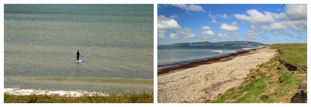
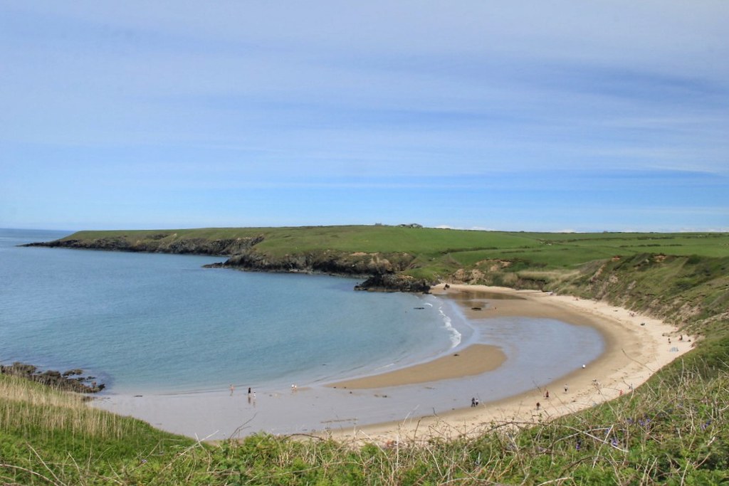
The Wales Coast Path then follows the headland around to Mynydd Cilan before dropping down on to the popular surfing beach of Porth Neigwl (‘Hells Mouth’). Nobody knows exactly from where the beach got it’s name, but popular belief seems to be that it possibly derives from the fact that the area is thought to have been the scene of as many as 30 shipwrecks over the past 180 years.
Hells Mouth is a long beach (approximately four miles), so I took my time walking along it, watching the surfers and stand-up paddle boarders as I did so.
I was also aware that the Wales Coast Path headed inland part the way along the beach at Hell’s Mouth, which gave me all the more reason to linger a little longer in order to soak up those stunning sea views.
Inland hiking often involves trudging across large areas of agricultural farmland. Unfortunately, due to a distinct absence of well-defined pathways (farmers simply provide a public right of way through their fields), it also presents a significantly increased risk of getting lost. Not to mention getting covered in mud and chased by cattle.
I managed all three.
To save you making the same mistake, here are a few tips for this part:
As you leave Hell’s Mouth beach, you’ll come to the Porth Neigwl car park and opposite, a signpost pointing left, along the road. You’ll follow this for what seems like forever (it’s probably only about a mile) until the road bends around to the right by a farmhouse and your map indicates a turning off to the left.
Now, the only turning I could see was a farm track to the left of some black-painted farm buildings, so I duly followed it. At the end of the track was a locked gate and zero Wales Coast Path signage. I contemplated climbing the gate and somehow finding my way back on to the official path (which, according to my map, I wasn’t far from). However, not knowing what obstacles lay ahead, and finding no-one around to ask for directions, I decided instead to retrace my steps along the road, assuming that I’d missed a turn off somewhere, on to a footpath that ran almost parallel to the road, but that continued onwards from the farmhouse.
I walked all the way back to Porth Neigwl car park without seeing a single sign.
As a result, I then had to walk all the way back to the farmhouse.
Don’t do this! It will add an additional three miles on to an already long day.
Instead, walk past the farm and to your left, slightly beyond where the map indicates it should be, is a Wales Coast Path sign, almost completely obstructed by trees. The trail takes you alongside the Afon Soch, through several fields containing both sheep and cows.
My tip here would be to follow the route on whatever app you have it mapped on (I recommend Footpath), rather than attempting to follow the signage – what there is of it.
You’ll eventually find yourself back on the main coast road leading to Aberdaron, which you’ll follow until you reach Plas yn Rhiw, an early 17th century manor house owned by the National Trust. The gardens here spread across more than an acre of land and offer some spectacular Llyn Peninsula views. Like Plas Glyn-y-Weddw on the first day, I had hoped to stop here for a while. But, after already wasting over an hour walking three miles I didn’t need to have done, I had to bypass Plas yn Rhiw if I wanted to make it to Aberdaron before evening.
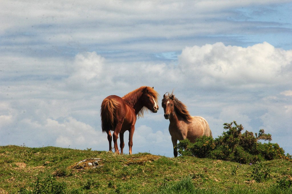
The footpath heads off to the left almost opposite the entrance to Plas yn Rhiw, and takes you through some lovely shaded woodland areas, before climbing back up on to the headland, and on to the trig point at Mynydd Penarfynydd. You may even be lucky enough to witness a couple of beautiful horses playing up on the heathland.
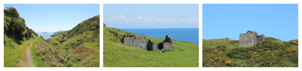
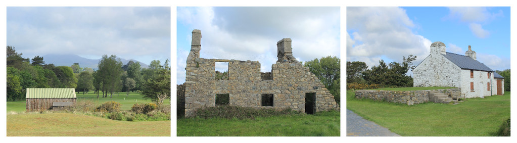
From this point onwards, the spectacular coastal scenery returns – starting with the beautiful cove of Porth Ysgo.
As you approach, keep an eye out for the remains of manganese mines, standing on the slopes above. Horses once carried the ore down to the shore, where beached ships were loaded up. Manganese mining was an important industry on the Llyn Peninsula, with the ore originally being used as an oxidising agent for the manufacture of bleach. At the time of the second world war, all of Britain’s manganese came from North Wales. Production ceased once the war came to an end in 1945.
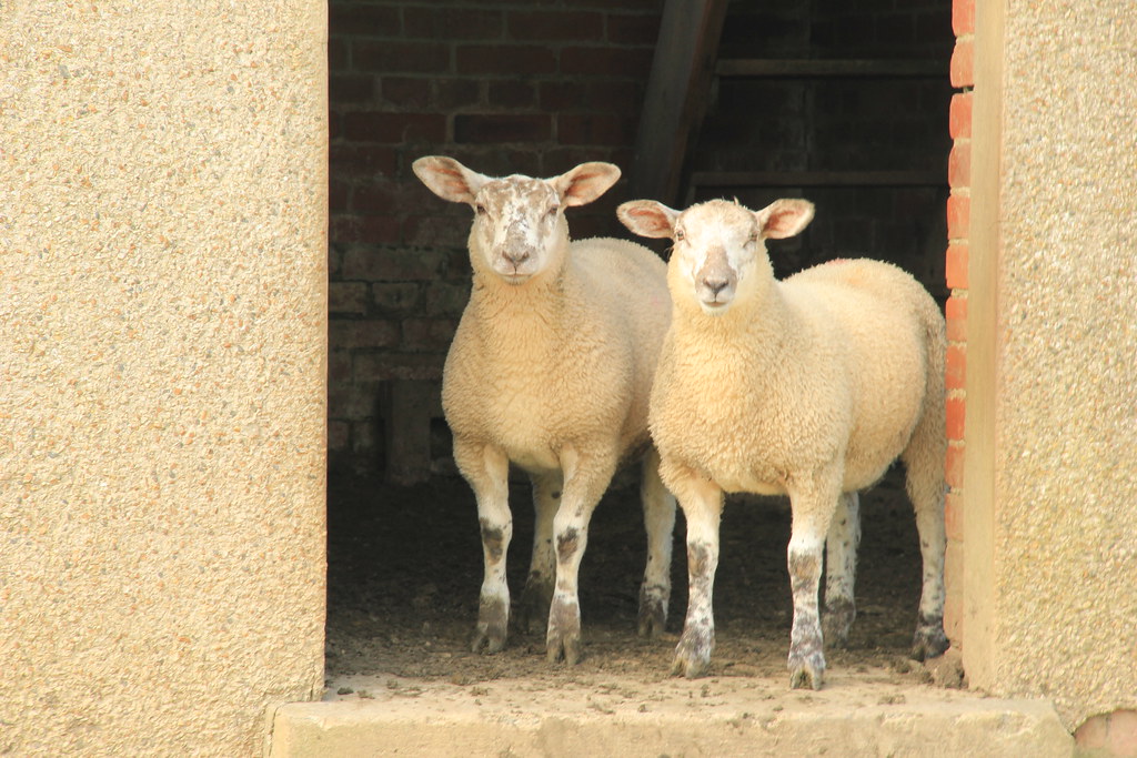
At this point, you haven’t left the agricultural farmland of earlier in the day completely behind you though; you’ll follow the narrow coastal trail through fields of sheep who have arguably the best grazing spot in the whole of Wales.

The island you can see in the photo above is called Maen Gwenonwy – ‘Gwenonwy’s Rock.’ Named after King Arthur’s sister, it can be accessed via a causeway leading from Porth Cadlan.
Shortly after passing Maen Gwenonwy, the track heads inland to join the Afon Daron, which flows into the heart of Aberdaron – the end point of my day two walk on the Wales Coast Path.
I’d arranged to meet Stu at a pub in town, The Ship Inn, for a post-hike beer. But it was a sit down I was looking forward to as much as the beer itself, because, as is always the case, those last couple of miles were the longest miles I’ve ever walked. As I neared Aberdaron, every step became more and more uncomfortable underfoot and, as a result I damn near hobbled to that pub – much to Stu’s amusement.
Day 3 | Walking the Llyn Peninsula from Aberdaron to Porth Colmon
Distance: 13.7 miles (22 kilometres) | Elevation gain: 678 metres
After a hearty meal and a good night’s sleep, my feet had recovered and I was ready to tackle a new day on the Wales Coast Path.
Knowing that I had six fewer miles to cover than I had done the day before, I set off with a spring in my step, climbing the hill that lead out of Aberdaron and took me high above Aberdaron Bay.
Although today was my shortest day of the three, it was probably the hilliest – especially the first section, which involved a seemingly endless series of ups and downs.
The trail actually drops right down to Aberdaron Bay, so if you’ve packed your cossie and feel brave enough to take a dip in our (not so warm) British waters, the bonus is that there’ll likely be no-one around to watch you.
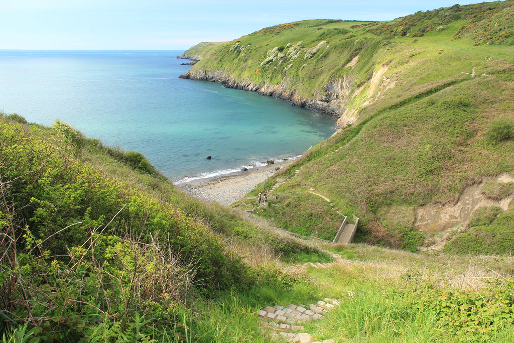
Preferring to keep my clothes on and admire the water from above, I continued onwards, following the narrow coastal trail along the precarious clifftops around Hen Borth, Porth y Pistyll and Porth Cloch.
This is another point along the trail where you’ll spot a multitude of rabbit warrens, and catch the odd glimpse of the furry creatures who inhabit them, hopping across the pathway ahead of you.
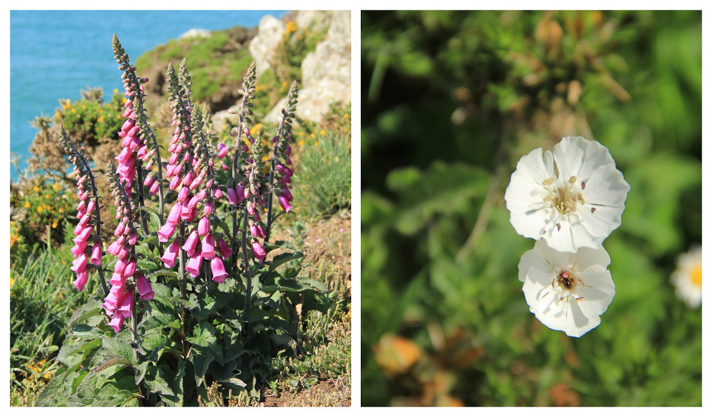
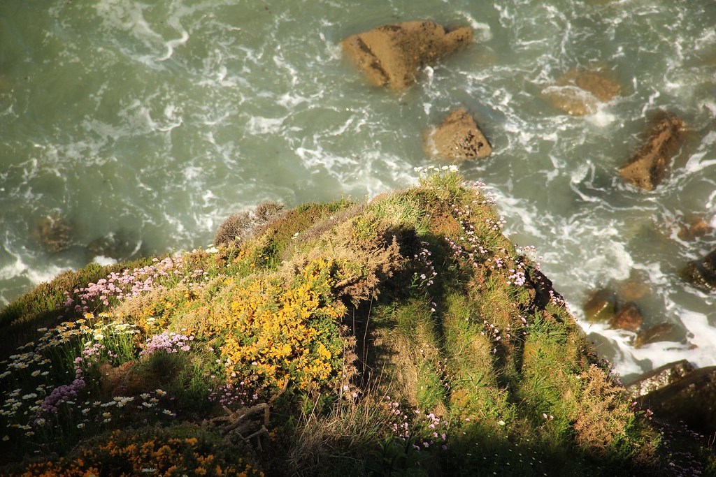
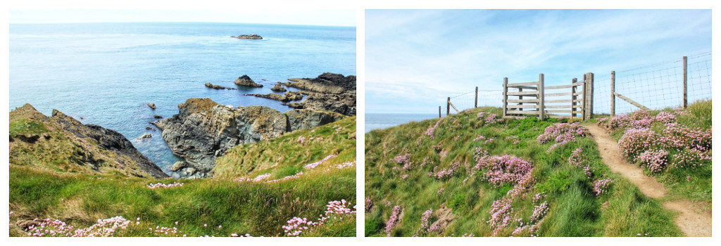
I loved how lush and green the landscape was at this time of year, and how many colourful flowers were in bloom. But, not much further along, grass-covered slopes dotted with gorse soon gave way to a more wild and craggy landscape, jagged rocks jutting out into the sea like claws.
This was definitely one section where I could not afford to take my eyes off the trail in front; one wrong footing may quite easily have seen me tumbling down a rather steep, stony incline towards the sea (slight hyperbole used for dramatic effect here, mum; no need to worry!)
But this section was as beautiful as it was precarious, and every photograph I took involved a rather delicate operation of stopping and securing a steady foothold before raising the camera to my eye. However, the strong winds did their best to ensure that this was no easy feat.
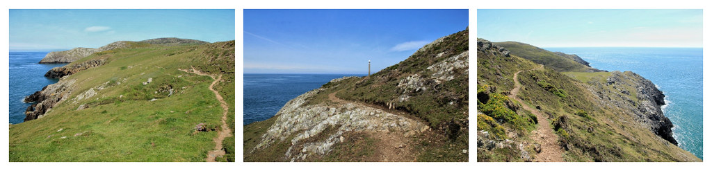
I was rather relieved when the trail began to snake its way a little farther from the edge, across an exposed common towards the coastguard station at the summit of Mynydd Mawr. There were larger rocks here that looked like they’d been scattered rather randomly by a mythical Welsh giant, shortly after he’d retrieved them from the sea bed. They made very good seats and gorilla pod mounts, in order to set up the photograph below.
Now owned by the National Trust, the coastguard station at Mynydd Mawr was used by the RAF as part of a chain of signal stations guarding against invasion in World War II. In the 1940s, over 70 RAF employees worked up here, and it continued to be a lookout point for coastguards up until 1990.
Its location marks the westernmost tip of the North Wales mainland, which means that the views from here are absolutely incredible! You can see Ynys Enlli (Bardsey Island) to the south, Anglesey to the north, Snowdonia to the east and the Irish coast to the west. I’m told that, on a clear day, you can even make out the mountains of County Wicklow, Ireland, on the horizon.

If you’d like to visit the coastguard station but you’re not much of a walker, it is actually possible to drive up to it. It did confuse me a little as I arrived at the road, because up until that point I was considering just how rugged and remote that stretch of trail was. And although there weren’t many cars around, it was still rather strange to be greeting other people as I walked. I’d not done that since leaving Aberdaron.
As I passed the coastguard station and started my descent, the views out to sea continued to stun and amaze at every opportunity.
If you fancy yourself as a bit of a wildlife photographer, you’ll be pleased to know that the sheep up here are a lot tamer than they had been along the earlier points of the trail. Mostly they seemed quite willing to stay still and pose for me rather than simply running away as I passed.

My next stop was Whistling Sands, where I thought Stu and I had arranged to meet for coffee. There’s a lovely little cafe down on the beach, where I managed to grab a seat at the one remaining free table outside. I sat down and shot a quick message to Stu to let him know that I’d arrived and that I’d ordered him a latte. Sadly I hadn’t realised that there was zero mobile phone signal down on the beach, so Stu didn’t know that I was waiting for him at Whistling Sands, and I didn’t know that he had no intention of joining me. Not at Whistling Sands anyway.
When my messages finally got through to him, he assumed I’d arrived at Porth Colmon already – the only location he was aware that we’d arranged to meet at today. So, that’s where he’d headed to – over three hours earlier than I would actually be able to join him. It would’ve been two but I’d spent almost an hour at Whistling Sands wondering where the hell he was.
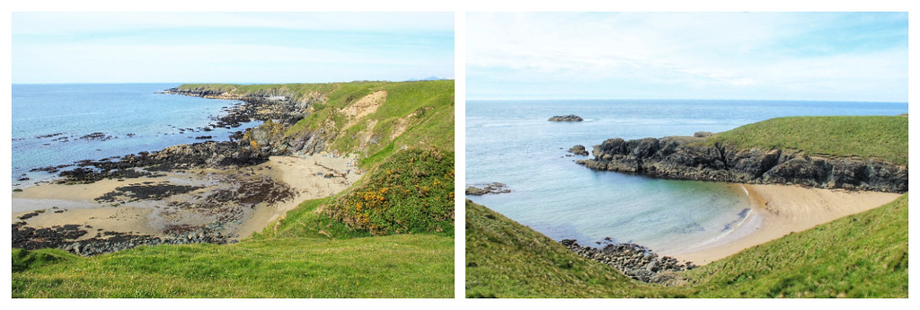
As a result of this miscommunication, I must admit that I rushed the final bit of the trail a little more than I would’ve preferred to – which is a shame because when you leave Whistling Sands, the grass-covered trail continues to hug the coastline, passing countless hidden coves and a few delightfully secluded beaches, too.
And if you visit during late Spring/early Summer, you’ll also find abundant clusters of Thrift (latin name: Armeria maritima) in flower, creating wonderful splashes of pink across the landscape.
When I arrived at the beach on the right (pictured below), I almost wished that I’d not wasted such a huge chunk of time at Whistling Sands; this place was much nicer and much less crowded. Although, it was distinctly lacking in coffee, and I really do look forward to my coffee stops on long hikes.
As I was nearing Porth Colman (much later than I’d anticipated, despite the increased pace I’d maintained since leaving Whistling Sands), I spotted a familiar face walking towards me. Stu had clearly gotten so bored waiting for me that he’d begun hiking the trail in the opposite direction! We walked the final couple of miles together and then hot-footed it back to Pwllheli in time to get showered and make our 6:30 p.m dinner reservation at Whitehall.
And that was 45 (or 48, if you count the additional three miles I ‘accidentally’ walked!) miles of the Wales Coast Path! Although my legs felt as though I’d walked far enough by the end of the three days, my curiosity wanted me to carry on. And, if it hadn’t been for the fact that the rains returned the very next morning, I may well have been very tempted to do so.
Walking the Wales Coast Path | Accommodation in Pwllheli
I booked four nights at Rooms at Martha Jones – a clean, comfortable and cosy space, located on Pwllheli’s high street.
The suites (of which there are just four) are all managed and run by Paula and Steve – owners of the ‘Martha Jones Card and Gift Shop’ downstairs.
The bed was super comfy, there’s a huge bathroom with a lovely hot, powerful shower, and a small kitchen area containing a mini fridge, crockery and cutlery, and an actual coffee machine – so you can have real coffee for breakfast every morning! The artwork on the walls creates a nice personal touch, and is all available to purchase from the attached gift shop.
Breakfast is included in the price of the room (which makes those high UK prices a little easier to stomach!) and is a basket filled with porridge, cereal, pastries, cereal bars, yoghurt and fruit. Whilst I love the treat of having a cooked breakfast when I’m away from home, this alternative worked out perfectly for me as it meant I could eat breakfast at a time that suited me and take what I didn’t eat with me in my hiking pack, as I set off to walk the Wales Coast Path.
Where to eat in Pwllheli
We were somewhat limited in our choices of eating and drinking establishments in Pwllheli. The oldest pub in town, Penlan Fawr Inn, seemed to be permanently closed, even though Google thought it should be open (a lockdown casualty, perhaps?), and we walked past a couple of other restaurants on the evening we arrived whose doors were also shut. But, I can recommend the following – both for very different reasons.
Pen Cob
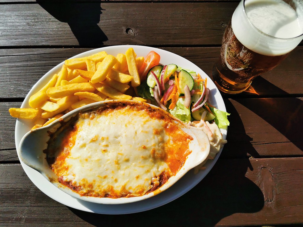
Located down on the seafront, Pen Cob is the local Wetherspoons. Ordinarily, this is the kind of place that I would immediately veto (I prefer smaller, independent cafes and restaurants over large chains), but we ended up eating here on our first evening Pwllheli simply because it appeared to the only place open. And I have to admit that I was pleasantly surprised by the service and quality of food. The value for money is also incredible: if you go for a veggie option, you can get a main course and pretty much any alcoholic drink on the menu (double/triple shots excluded and I don’t think they serve champagne!) for between £6.50-7.50 (correct May 2021).
Whitehall
We almost bulked at booking a table here because the starters were the same price as our whole meal (including our drink) had been at Wetherspoons, but in retrospect I’m so glad we didn’t. Whitehall is a cosy family run gastro-pub that’s located just off Pwllheli’s high street. The menu here is seasonal, using locally sourced ingredients, and you’ll find contemporary artwork by local artists adorning the walls inside.
I went for warm teryaki salmon and sesame seeds with salad and aioli and Stu chose the 8oz rump steak, and we shared a cheese platter for dessert. We washed it all down with a lovely bottle of Spanish ‘tempranillo’ red and congratulated ourselves on what a good choice we’d made by coming here. The food was delicious, the staff were friendly, and the whole place had a wonderfully relaxed and intimate vibe.
If you want to be sure of bagging a table, I’d recommend making a reservation. We attempted to simply walk in on the Wednesday evening, but even as early as 6 p.m. we were advised that they were fully booked for the night.
Enquiries and reservations: 01758 614091 | hefinatyddyncae@hotmail.com | http://whitehallpwllheli.co.uk/en/home/
Wales Coast Path | Further Reading
I used a number of different internet sites to conduct my research on walking the Llyn Peninsula section of the Wales Coast Path. This Wales Coast Path website was particularly helpful, and is run by Northern Eye Books Ltd, who publish a number of maps and official guidebooks about the trail.
There are several Wales Coast Path books available to buy online. Based upon reviews, I purchased this one, but then realised that it’s written for those walking the Wales Coast Path in an anti-clockwise direction, which meant that it was a little tricky attempting to switch all the directions around in my head. I think I assumed that, like my Hadrian’s Wall Path guide, it would contain maps and route notes for both directions! That said, it was still useful for the detailed information it provided about the route, and for the public transport, parking and accommodation options it offers for each individual section of the trail.
It’s also proving very useful for planning the next part of the Wales Coast Path I’d like to walk. A couple of good friends of mine have recently relocated down to a little village near Carmarthen in southwest Wales, so the intention is to tag a few days along the Pembrokeshire part of the Wales Coast Path on to a visit to see them. I doubt I’ll be as lucky with the weather again next time, but I live in hope!
If you enjoyed this post on walking the Wales Coast Path, why not pin it to one of your Pinterest boards?


No Comments