

Flicking through the pages of the Explore travel brochure, I kept coming back to the ‘On foot in the Picos de Europa‘ trek…I’d never visited this region of Spain before, and it was so close to home yet the scenery was other-worldly: there were the lunar landscapes and imposing limestone peaks of Naranjo de Bulnes, the glacial lakes of the Western Massif, and dramatic gorges that sliced their way through the mountains. The scenery looked not only stunning, but also diverse, and the dramatic shifts in elevation suggested that I would experience a wide variety of ever- changing vistas, terrain, climate, flora, and fauna.
I’d booked what are labelled as ‘adventure holidays’ before but I’d never signed up to a ‘trek’. I was excited to be doing so though. As someone who enjoys outdoor activities, walks everywhere, and spends over 2 hours down the gym at least twice a week, many of the group holidays I’d taken just didn’t incorporate the level of physical activity that my body was used to. I love travelling on local transport, but moving from bus to train to tuk tuk to motorcycle to rickshaw to elephant to camel, did not allow any room for the mode of transport I love the most: my own two feet.
The difficulty level was graded as “moderate“, so I confidently assumed that – for someone who considers themselves to be moderately fit – the trek, whilst comprising some relatively steep ascents and descents, should not be overly challenging.
I couldn’t have been more wrong.
Aside from the short bursts of uphill cycling I struggled through the following May, when I cycled the Adriatic coast from Venice to Porec, my Picos de Europa trek has to be the most physically challenging week of my life to date.
So where exactly are the Picos de Europa?
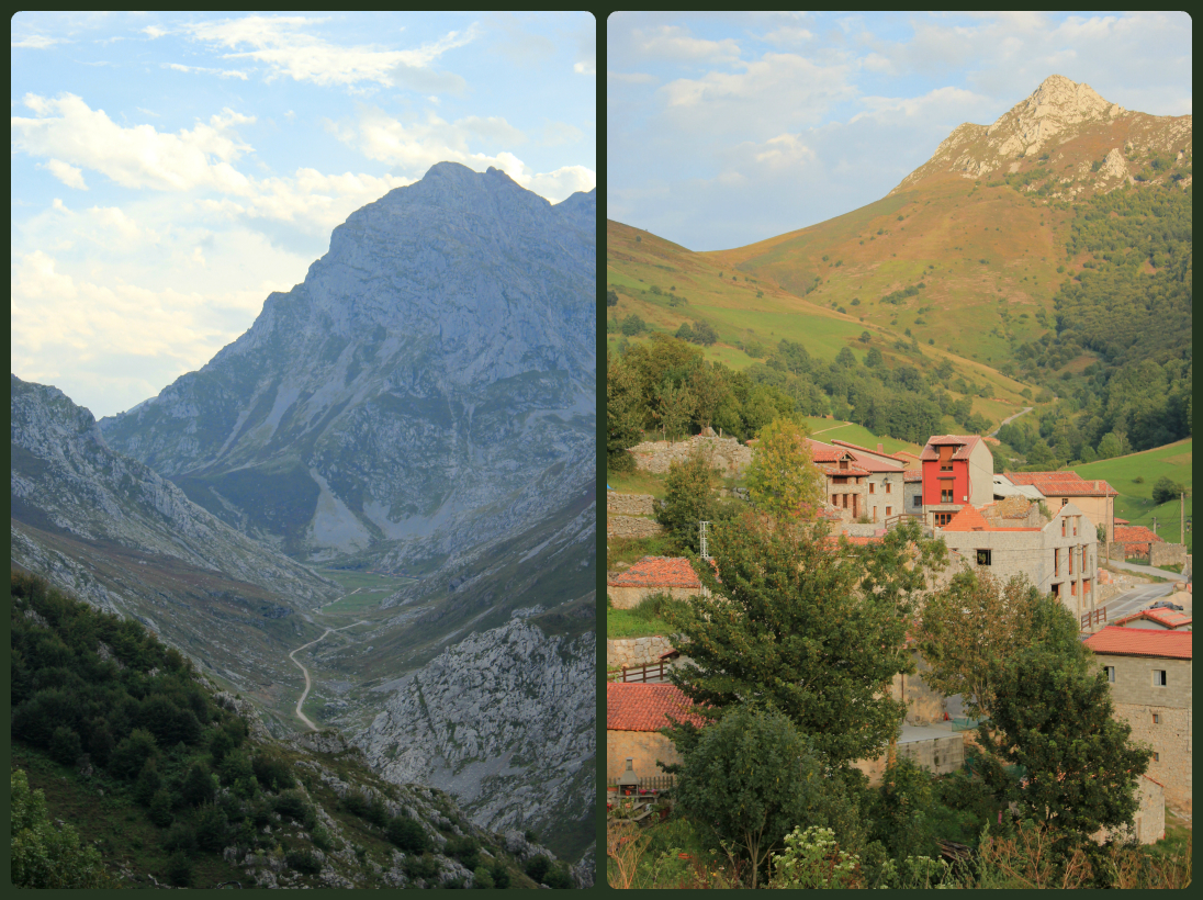
The Picos de Europa (literally “peaks of Europe“) is a range of mountains 20km inland from the northern coast of Spain. Forming part of the Cantabrian mountains, the Picos de Europa were reportedly the first sight of Europe for ships arriving from America, which also explains the origin of their name. The highest peak is Torre de Cerredo, with an altitude of 2650 metres, however there are numerous other peaks in the Picos which also reach over 2600 metres.
As you would expect, the area is immensely popular with climbers, mountaineers and mountain walkers, and although they are catered for by a well-established network of mountain refuges, it’s not recommended to go hiking here without a guide. Tracks are not always clearly marked, weather can be variable and unpredictable and mobile phone signal is pretty much non-existent.
***
The nearest airport to the starting point of our trek was Bilbao. Whilst I had considered not booking the group flight and arriving a day earlier, in order to have a mooch around the infamous Guggenheim Museum, I decided that exploring the capital of Spain’s Basque Country was probably an activity best saved for another occasion. I always try to fit too much in to my schedule whenever I go away, so this time I would simply concentrate on the trip in hand.
So I arrived into Bilbao airport, met up with our guide Juan and the other members of the small group I would be trekking with (who were a pretty even mix of men and women but with ages varying from mid-twenties right through to upper sixties), and all 10 of us piled into a minibus, which transported us through scenery which was probably quite spectacular had it not been too dark to see.
So the following morning I awoke, in a lovely little guest house in the village of Espinama, not really having any idea as to where I was or what adventures lay ahead of me that day.

A few photos of the pretty village of Espinama, which I was able to take later on that day
As we all gathered outside, clutching our lovingly prepared (by the staff at Posado Maximo) packed lunches, I glanced around at the other members of the group – all of whom were also clutching walking poles. Now I’d never owned a pair of walking poles, never used a pair of walking poles, and to be completely honest I’d never really understood the point of them if you’re generally fairly steady on your feet. To me they were just extra items to carry when I already had a fairly bulky digital SLR camera to contend with.
But standing there, on that crisp, clear morning, watching the tops of the surrounding hills gradually come to life as the beauty of the sun’s rays shone upon them, I did start to feel as if I was missing something rather important.
When we arrived at Fuente De, the first task was to take a cable car to the upper station. As we climbed higher and higher and and the houses and cars down below grew smaller and smaller, we were leaving behind us a landscape of lush, green, forest-covered hills. However, as we exited the cable car station, we were confronted with a very different panorama: although the sun was now shining brighter than ever and the skies were a rich blue, this new vista was more stark, more barren – almost lunar in its appearance. I’d never seen anything like it before in my life.

Some of our group as we started our 8-day trek through the Picos de Europa

The pathways looked a lot narrower than they actually were!

I put a few people in the photo to give some scale to the landscape…yes the rocks were huge!
Day 1: Keep your eyes on the path ahead
So we set off to explore this barren, lunar landscape, one which – due to the nature of its topography and the fact that it was almost totally devoid of vegetation – offered us no respite from the heat of the sun’s rays. Narrow pathways snaked their way between imposing rocks. Loose scree covered the mountainside, over-spilling on to the terrain below our feet.
The hike started well: I chatted to other members of the group about travel experiences, photography, and wildlife, I snapped photograph after photograph of the strange, dramatic and intriguing vistas that constantly surrounded us, of the countless peaks spreading out into the distance, and of other hikers; tiny dots of colour against a stark grey background of jagged rocks, giant boulders, and broken stones.
As we climbed higher towards the peak of Torres de los Horcados Rojos, I started to long for some shade. But I had one goal in mind: imagine how incredible the view will be when you reach the top, and that spurred me on. It even helped me to shuffle along a narrow precipice, clinging desperately on to the rock in front of me, because ahead of that was the first of many peaks we climbed that day, and below me was the tiny path we’d trodden in order to get there.

The path we’d just trodden and the distant mountain peaks filling the horizon

A mountain cairn, Torres de los Horcados Rojos
Despite the heat, the trickiest part of today’s hike was keeping my eyes on the path ahead. One foot wrong on a terrain of broken rocks and mountain scree, could quite easily result in a potentially painful tumble down a steep, rocky slope. Not to mention the possibility of sliding into fellow hikers, and thus creating a domino effect down the mountainside. Yes, it was in our own interests and the interests of everyone else in our group, that we focussed on the ground in front of us, which is difficult when you’re surrounded by such awe-inspiring scenery.
As we were making our way down the final and highest peak of today’s hike, I started to appreciate the benefits of walking poles. They aid balance, much like skiing poles do. Whilst I do think it’s important to learn to be sure-footed, understand how to distribute your body weight effectively, and be able to accurately assess the positioning of your footing as you walk, walking poles can make all of these things that little bit easier – thus allowing you time to glance around at the beautiful landscapes through which you have chosen to hike.
As we headed back to Espinama that evening, I considered that, whilst today had not been overly physically challenging, it had been a good introduction to the kind of terrains we’d be hiking over the next 7 days. Moreover, I had been completely blown away by the scenery and was excited to see what other surprises this region had in store for me.

The village of Espinama, northern Spain

The local cats came to say hello 🙂
Day 2: Never trust the weather! Learning to pack wisely – the hard way
We awoke once again to some beautifully clear skies, which – by the time we’d reached the starting point of today’s hike – provided a rich blue backdrop to the lush green countryside. The scenery today was a complete contrast to yesterday’s stark, grey, barren lands.
We began walking – steadily uphill – on a wide road beneath some dense tree cover. Sarah (my room mate at our accommodation in Espinama) and I strolled ahead, both pleased we had found another who chooses the same pace as herself. In between the trees we caught glimpses of green hills topped with rocky outcrops and dotted with small trees and stone houses with red-tiled roofs. We shared the road – which became more of a gravel track the further we climbed – with Land Rovers and farm dogs running alongside, and with shepherds guiding their flocks.

Signs of local farmers at work

Majada de Iguerdri
Leaving Majada de Iguedri, we continued along the gravel track towards Puertos de Aliva. Whilst still green, the landscape became rockier and more dramatic. Cows, horses and donkeys grazed. A tiny stone church was just visible at the end of a narrow trail, dwarfed by the craggy mountains surrounding it. A few low-lying clouds drifted into view. But the temperature was still warm and the sky still very blue.
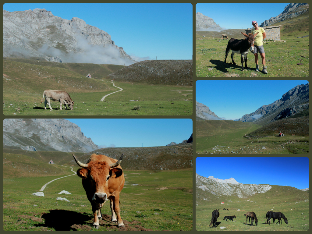
The landscapes of Puertos de Aliva

The gentle sloping terrain and craggy mountain backdrop
In the time that it took us to walk from one side of the valley around to the other (which can’t have been more than about 10-15 minutes), that beautiful blue sky with just a smattering of low-lying clouds, had transformed into this…

Map reading became suddenly essential as the path in front of us was completely engulfed in cloud
The temperature dropped quite dramatically, and other members of the group began to zip the bottoms on to their convertible shorts, and don fleeces and waterproof jackets.
Everyone – except me.
I didn’t pack any additional clothing. Stupidly I assumed that the nigh on perfect weather we’d had up to this point, would continue. When I was getting dressed and packing my daysack that morning, all I could think about was how blinding the sun had been the day before, and I was concerned about ensuring that I didn’t wear too much or pack too much, so as to make the hike uncomfortable, and the weight unnecessary. It never crossed my mind that the weather could change so dramatically and in such a short space of time.
No-one else had any clothing to offer me, because they were all wearing everything they had brought – and they needed it. Besides, I only had myself to blame for the position I now found myself in: wearing nothing more than a t-shirt and a pair of shorts in temperatures well below 10 degrees and with strong winds to boot. At first I shunned the worries of my fellow hikers, insisting that I was ok, the cold front would blow over soon enough, and that the walking in itself would keep me warm. As time went on, I stopped shivering, and the goose-bumps disappeared, but I felt colder than ever. It wasn’t just a surface chill any longer; it was running much deeper than that. I started to understand where the phrase “chilled to the bone” comes from.
The more I walked, the more it looked like this weather was here to stay, and the colder I became. As we neared Sotres, I have never been so pleased to see a steep ascent ahead of me in all my life. The steeper the incline and the faster I walked it, the warmer I would become. So, as we climbed higher and higher up into the mountains, I walked and walked and walked, and did not stop until I reached the guesthouse in Sotres, our home for the next few nights. For what seemed like an eternity I was dreaming about the lovely hot bath I would have when I got there. The bath, it turned out, was the smallest bath I’ve ever seen – more like a square tub designed for hobbits. Fortunately, measuring just 5’1, and weighing just over 7 stone, I pretty much fitted (with my legs crossed) into the bath perfectly, and it was, hands down, the best bath I’ve ever had.
Day 3: Life above the clouds, and the uphill struggle to get there
Warm bath, cold beer, hearty meal and an amazing sleep later and I was more than ready to face the day. Today I’d packed layer upon layer of clothing for every eventuality, including a waterproof jacket and woolly hat. No amount of bad weather was going to beat me this time. As we set out for our walk around the Sotres region today, the area was still engulfed in a blanket of stubborn grey cloud. It hadn’t rained and wasn’t raining, but so much moisture lingered in the air. Grasses were wet, tracks were slippery and glistening cobwebs hung beautifully between plants and flowers, tiny droplets of water decorating their core.

The moisture in the air created these beautiful glistening cobwebs

I love the intricate detail here
We followed well marked tracks as they crossed the hillside, passing grazing cattle, herdsmen’s huts and makeshift signposts, propped up with rocks.

The kind of scenery we passed on the route up to Refugio de la Trenosa
Our climb today took us up to the refuge at Naranjo de Bulnes (Pico Urriellu in Asturian), 2519m above sea level. Although this was one of the hardest hikes all week, it was also my favourite. Not because I’m a masochist but because I loved the contrasts in scenery. I loved the early morning dew effect on the plants and flowers, I loved the mystery of the fog-like cloud, and I loved the fact that the people here live in harmony with the land and with the cattle who graze upon it. It felt like a beautiful, serene part of the world, untouched by tourism, technology, and modernisation.
The higher we climbed, the more remote the environment became, and the more dramatic the landscape. Narrow tracks continued to zig-zag up the mountain, we walked in single file so as to stay away from the edge. The moisture in the air was bringing humidity with it, so whilst I needed my waterproof to prevent the rest of my clothes becoming wet, heavy, sticky, and uncomfortable, wearing it was desperately uncomfortable too. As the path narrowed, we had to pay even more attention to the slippery rocks ahead of us, and in some parts the cloud cover was so thick we could barely see the person in front.
Still we climbed. And climbed. And climbed.
I was hot, sticky, and uncomfortable. My legs felt like they were about to buckle beneath me. But I was determined to stay in front, partly because I have an innately competitive nature (doesn’t everyone to some degree?) and partly because I was worried that if I lagged behind, I’d never catch up again. In order to stay in front, I had to keep walking, no matter how much my legs were telling me otherwise. After what seemed like forever, I turned a bend and could see blue skies up ahead. The cloud was clearing. Or so I thought. But then I realised that it wasn’t that the cloud was clearing, but that I was walking through it. I was actually climbing above the clouds. In a matter of seconds the weather had changed just as it did the day before – but in reverse. Above the clouds, it was warm, sunny, and dry.
That’s another reason why I loved today. Today was the day I climbed above the clouds.

Above the clouds
I assumed at that point that we must nearly be at the refuge. After all, we were now above the clouds, how much further could we climb?
A lot, is the answer.
The rocky track continued to weave it’s way up the mountain, but the nearer to the end it got, the steeper it became, and because of its zig-zag nature, it was impossible to see just how much more ground we had to cover. Every corner I turned, I hoped and prayed it was the last. My legs simply couldn’t take any more.
Fortunately my stubborn, determined mind could.
And when I reached the top, it was all worth it.

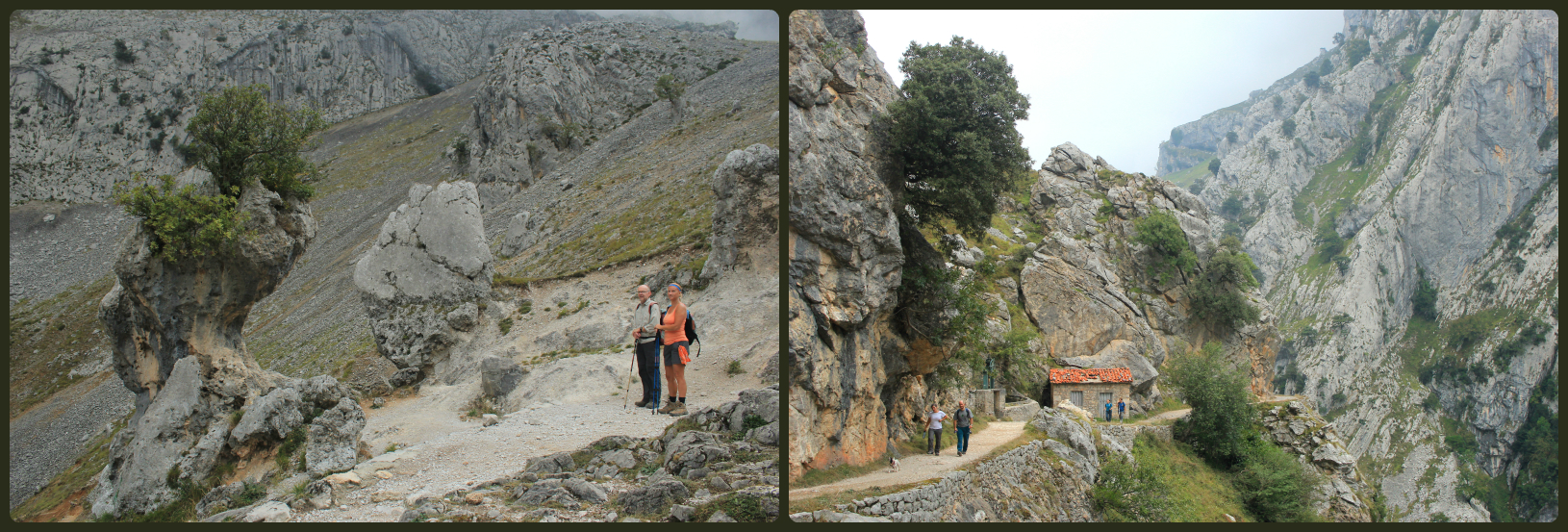
The last stretch, just before we arrived at the refuge
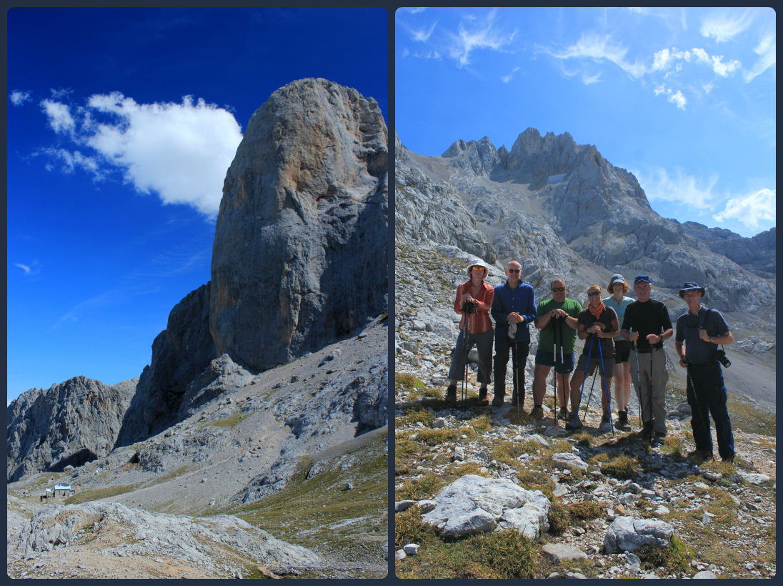
Naranjo de Bulnes and the refuge down below, and a few of the members of our group with our excellent guide, Juan

The route back down to Sotres
Day 4: Back to Nature
Today the walk was a lot more leisurely, which – after yesterday’s physical challenge – my legs were very grateful for. We started the hike at 1395 metres above sea level, through the Valdediezma beech forest. It was lovely to see so many different varieties of plants, flowers, and fungi along the way, to cross flowing streams and scramble through dense undergrowth.
As we exited the forest, we followed the Sobra Valley towards the small village of Treviso. We passed huge numbers of nettles and ferns, crumbling old buildings, evidence of cattle having trodden the same paths, and farmers tending to their land. I was also delighted to spot several lizards hiding between the cracks in the rocks, and those were occasions I didn’t mind lagging behind while I stopped to photograph them.
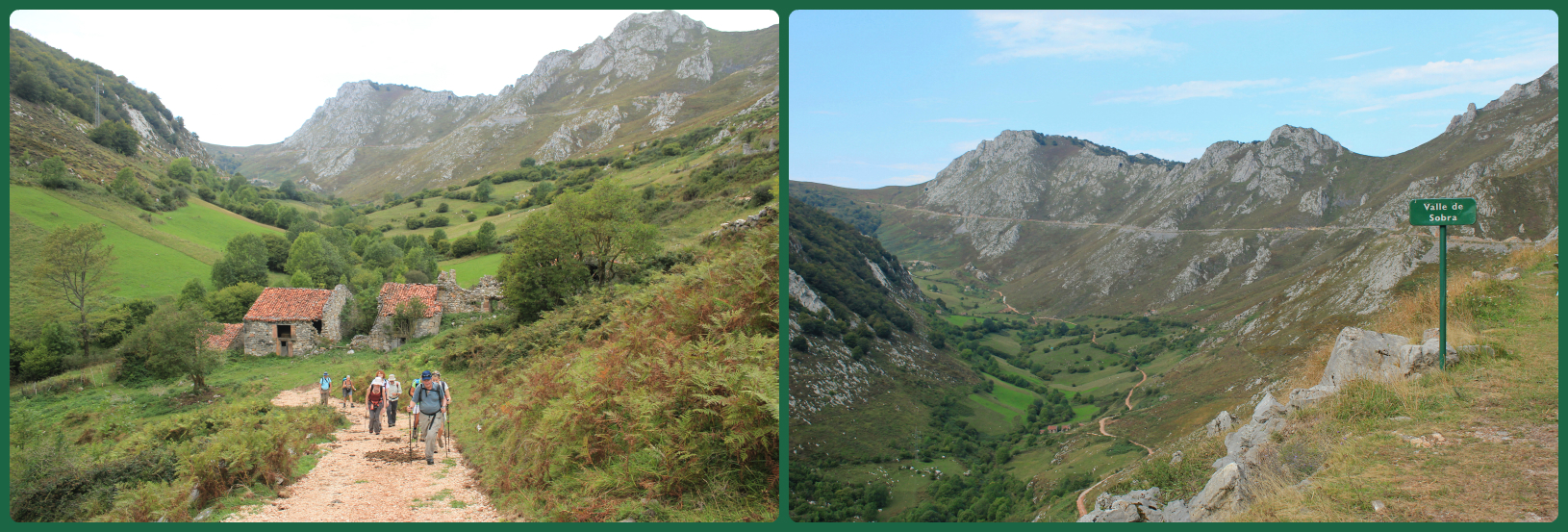
Walking the Sobra Valley
The town of Treviso
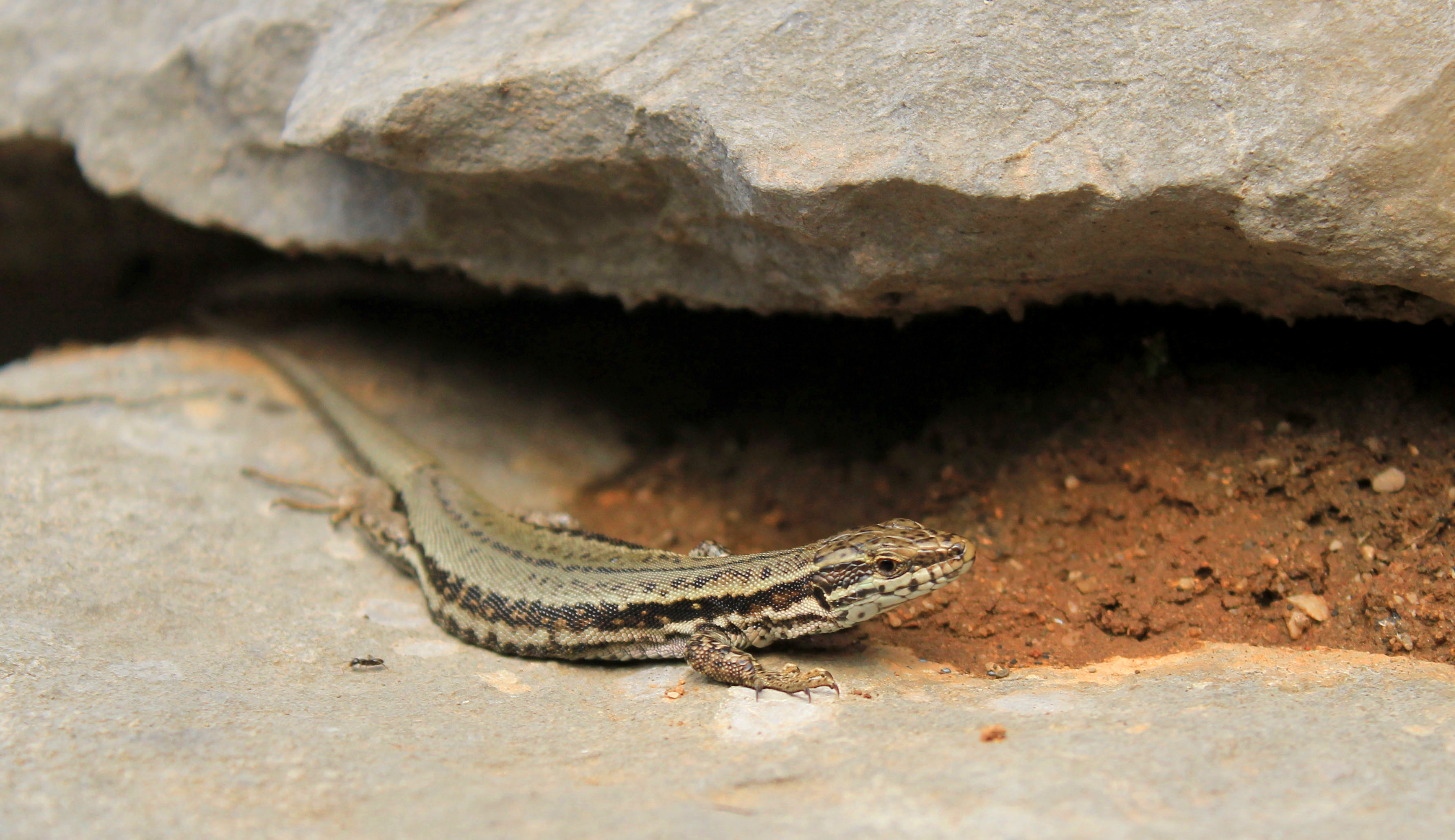
One of the few photographs I managed to get before he slithered back underneath the rock
After a brief stop for lunch just outside the pretty village of Treviso, we started our descent to La Hermida Gorge. When I looked down upon the meandering path below us, I knew the tracks we were about to walk upon would be steep, rocky, and uneven, but unlike many of my fellow hikers who struggled with their knees on the long downhill stretches, I beheld the dramatic switchback as it snaked it’s way across the craggy limestone peaks, and smiled.
I was looking forward to the journey.

Stunning scenery as we began our walk down into La Hermida Gorge
Not, I suspect, quite as much as the 2 guys who passed us on mountain bikes, and who we witnessed riding the switchback below without so much as a single moment of shaky uncertainty. They were speeding along the track, maintaining perfect control of their bikes around every sharp bend they encountered.

The perfect road for mountain-biking?
Normally a steep descent such as this would signal an equally gruelling ascent – but not this time. This time we reached the bottom of the gorge and walked alongside the riverbed, crystal clear green waters washing gently over the rocks as we passed. When we reached Udon at the other end of the gorge, the minibus was waiting for us, and our driver transported us safely back to Sotres just in time for me for me to take a leisurely stroll around this beautiful little village at dusk.
It did confuse me a little as to why none of the other members of the group wanted to do the same, but I appreciated the time alone. Just me, my thoughts, my senses, my camera in hand…
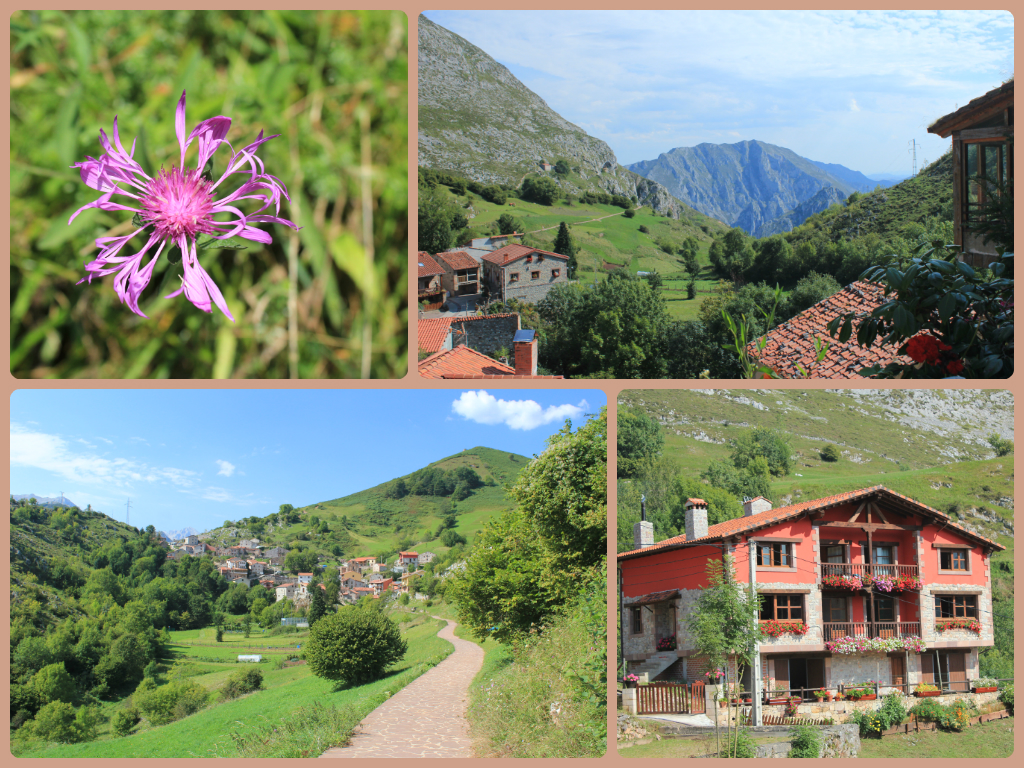
Sotres is a village that spreads upwards rather than outwards, so the top of the village affords some beautiful views of the surrounding countryside; of rugged mountains, lush valleys, dense forests and grass-covered hills. The few streets of the village itself are lined with stone houses with red-tiled roofs. Fuschia pink and deep burgundy flowers decorate the windowsills, along with an assortment of phallic cactii. Cats tiptoe along the uneven stone walls, and hide in the long grasses.
The last few rays of sunshine gave the hills and the tops of the houses a beautiful golden hue
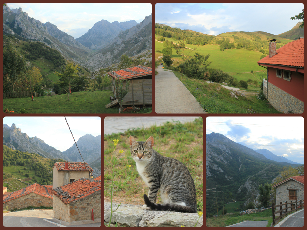
The village of Sotres

As the sun begins to set behind the mountains
Day 5: Wishing for some blue skies
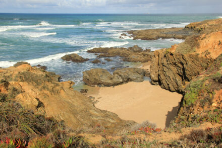
Today was the one day I was looking forward to above all others in the trip. The photos I’d seen of the Garganta del Cares (Cares Gorge) were truly stunning, and the reviews had labelled this as the highlight of the trip. So when we arrived at Puente Poncebos – the starting point for the walk through the 12km long gorge – to discover that the landscape was shrouded in a grey mist of low-lying cloud, I was more than a little disappointed. The cloud had hidden the tops of the mountains, dulled the colours of the trees, and dimmed my spirit. Still, we had a 24km hike in front of us – potentially 6/7 hours of walking – so surely the weather would clear within that time…
Fortunately it did. A little, at least.
Cares Gorge – looking a little brighter than when we first arrived!
Despite the terrain being relatively flat and the paths relatively stable, there was much to keep us focussed and hold our attention. The Cares river has carved this magnificent chasm of natural beauty through the heart of the huge limestone Picos range. Between cliffs and crags, thinly forested couloirs soar for hundreds of metres to the impossibly distant peaks framed between their walls. The river has been partially diverted for hydroelectric power, and the path we took was the related maintenance path, winding its way around the smooth walls of the gorge, hundreds of metres above the river. It’s wide enough to safely walk upon, but when you have to pass fellow walkers approaching from the opposite direction, you are sometimes forced to tread frighteningly close to the edge.

The narrow pathway wrapping its way around the mountain’s edge
Being mid-September, the leaves on the trees were beginning to display their beautiful autumnal shades of gold and bronze. Mountain goats perched on craggy rocks, chewing vegetation, and watching us curiously with their beady glass eyes.
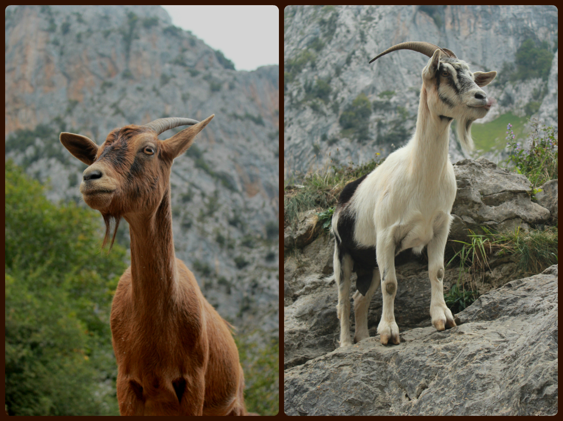
Mountain goats, Cares Gorge
By the time we reached the other end of the gorge, 12km later, the sun was trying to break through the clouds, and the surface of the river started to glisten as the suns rays reflected upon it. We ate lunch in the sunshine and were feeling positive that our return hike would afford some better views of the spectacular scenery that rose up dramatically at either side of our path.

Beautiful autumnal colours and the sun attempting to break through the clouds
Not long after we started walking, the cloud cover began to thicken again, and the sky grew incredibly grey. I reluctantly accepted the fact that those amazing photographs that I’d hoped to capture were now an impossible concept, thwarted by the unpredictable climate of this area. Hey, at least it wasn’t raining.
Wasn’t.
We’d made it a little over half-way back when the heavens opened. This wasn’t just a little shower; it wasn’t a passing storm. It rained. And rained. And rained. Fortunately my waterproof jacket was roomy enough to be able to zip up over my camera, and the hood was big enough to shelter my face from the huge droplets of water leaking from the sky. We ran on parts of the path that it was safe to do so, and walked snugly beside the overhanging rock face wherever possible. Subsequently, one by one, we all converged at the cafe near to Puente Poncebos, and warmed our hands on mugs of hot chocolate, watching the rain rapidly creating puddles outside, torrents of water being washed down the channels of the tarmac road.
Day 6: Following in the footsteps of Miners
For our final hike in the area, we would follow an old miner’s track in Andarra (the Eastern Massif). For over a hundred years, mining was an important activity in this region, and its presence can still be seen by a network of tracks laid out across the mountain, many of which are ideal for walking along.

Evidence of the mining activity which once took place here
We began the walk on wide but uneven tracks, through farming pastures, the land decorated with plentiful clumps of heather and dotted with farming huts. We heard the cows before we saw them, the cowbells around their necks signalling their whereabouts on the nearby farmland. I love the sound of cowbells, there’s something quite relaxing and uplifting about wandering through a landscape where their sound travels gently on the passing breeze.
The next part of the route was a gradual but continual climb, initially through beech forests, before the scenery opened out, offering views over Karstic formations out towards the coast. This part of the climb was reminiscent of our hike up to Naranjo de Bulnes, and similarly this one became more difficult the farther up we climbed. Once again, we found ourselves leaving the clouds down below us as we continued our ascent to Andea Col, 1850 metres above sea level.

The climb up to Andea Col
To think that miners walked these tracks every day, was humbling. To remember that they walked these tracks without the help of walking boots or poles, and in a myriad of weather conditions, was admirable. I had no excuse. I was walking this path because I’d chosen to. I was walking this path because I was in awe of the scenery I’d witnessed over the past 7 days, and I simply couldn’t get enough of the dramatic panoramas that constantly surrounded me. I was walking this path because the physical challenges I’d pushed my way through so far had been liberating, uplifting, and rewarding.

Spectacular mountain scenery on route to Aldea Col
All of those thoughts spurred me on, as my legs were weakening, as I struggled to regulate my breathing, and as every muscle in my body was begging me to rest. The stony track gradually disappeared below my feet, and ahead of me lay the task of picking the best route over a terrain of varying sized rocks that had embedded themselves in the ground beneath. The land became so steep that the last part of the climb was little more than a clumsy scramble up to the top. At this point I wasn’t really aware of how far behind my fellow hikers were, and it wasn’t important. This was my time, my challenge, and I wasn’t going to stop until I’d beaten this mountain; until I was close enough to touch the statue of a robed Jesus, which signified the peak of the mighty Aldea Col.

View from the peak of Aldea Col

Caseton refuge, an old miner’s hut that we stopped at briefly in order to break up our descent back to Jito de Escarandi
Back at our guest house in Sotres (which also happens to be the family home of Juan’s wife), we were treated to a Asturian feast of Fabada Asturiana (a filling sausage and bean casserole containing white beans, onion, blood sausage, chorizo and garlic), Caldereta (a delicious fish stew), Merluza a la Sidra (Hake baked with clams, onion, garlic, potatoes, tomato, potatoes, apples and a little cider), Calamares (deep fried squid) as well as local cheeses (including Cabrales) and hams, all washed down with some tasty local red wine.
Unfortunately, being a non-meat eater, I’m unable to tell you how nice the Fabada Asturiana was, but the gorgeous smoky aroma almost persuaded me to bend my principles on this one occasion. This feast alone was a perfect finish to what had been a totally incredible week in this rarely explored part of northern Spain. However, after our meal, we all converged in the bar area and our tour guide and host, Juan, appeared with a bottle of local honey liqueur (hell, it’s even named after the mountain range!), and poured us a shot glass each on the table. Even those in our group who aren’t big drinkers, still insisted on raising a glass and making a toast to Juan, to the magnificent Picos, and to each and every person in the group, for not only successfully completing the trek, but also for helping to make the trek an enjoyable and memorable experience for everyone else involved.

Juan pouring the Picos liqueur…Salud!
Ok so you’ve read the article (hopefully enjoyed it a little!) and admired the photographs, but you may be asking,
“exactly how fit do I need to be to do a trek like this?”
The answer to the question is ‘reasonably’. But seeing as ‘reasonably’ is a relative statement, I will try and elaborate a little. I think it’s important to have done a fair bit of walking before, and obviously, to enjoy walking. I wouldn’t say it’s necessary to have done much hill walking, because I don’t and hadn’t done before the trek. I did, however walk home from work most nights (which took me an hour each time) and I did spend a couple of hours down the gym approximately twice a week, primarily doing cardiovascular work. However there were those on the trek who didn’t lead as active a lifestyle as that, and who were much older than me, but still managed it.
I think the answer is that whilst physical fitness of a certain level is important, it’s much more important to enjoy walking, to love mountain scenery, and to be prepared for the unpredictable climate and weather conditions within the region.
A little bit of stubborn determination helps too 😉
Footnotes
If you’re interested in finding out more information about the ‘On Foot in the Picos de Europa’ trek, or having a look at the route map, you can view it on the Explore website here. The route has changed slightly since I did the trek. Now you now fly in and out of Oviedo airport instead of Bilbao, you do not stay in Espinama at all (the first night is spent in a mountain town called Benia de Onis) and the initial two days of trekking follow a different route entirely. Obviously I cannot comment on whether the new itinerary is an improvement, but I do know that Explore always ask their customers to fill in an in-depth feedback form at the end of their tours with a view to developing their tours in line with that feedback.
Personally I loved the itinerary on the trek. I thought it was a wonderful and diverse mix of landscapes, and that the challenging trekking days were usually preceded with/followed by a more gentle hike, to give your legs a bit of a rest.
If you’d like to read up on the Picos de Europa region of Spain in general, try the following links to a couple of good (in my opinion) guidebooks on Amazon:
Lonely Planet Cantabria & Asturias
Have you ever hiked in this part of Spain before? Any similar experiences you’d like to share?
If you like this article, please please share it on social media using the share buttons at the top of the post. Alternatively you can follow along on Facebook, Twitter, or Google+ or you can look me up on Instagram or Pinterest too!
PIN ME!!!


10 Comments
Wow, that’s an amazing amount of information, and great photos too…I’ve never explored the picos but clearly need to rectify this, looks like a stunning place to hike!
Haha I always get carried away and end up writing way too many words! The Picos definitely surprised me, it’s a truly spectacular part of the world 🙂
gorgeous photos – such varied scenery
Nice pictures! Looks like a tough hike but definitely worth it!
Wow…what an amazing post. Looks like that was a truly rewarding adventure…definitely sounds like it was worth the effort. The photos are absolutely stunning – the little villages look so picturesque and the views are to die for. Congratulations on all your hard work and safe travels in the future!
really cool article and great pics…but you gotta do the work to get them right?? @weirsworld
You’re eventually going to get sick of me saying it, but I love your photos. I love your photos. And, I want those goats…and cows. Lovely post, as usual. Thanks for linking up to the #SundayTraveler–I really look forward to your posts every week 🙂
Thanks so much Ashley, that means heaps to me! Comments like that make me feel all warm and fuzzy inside & inspires me to continue writing (and taking photos!) I am looking forward to following along with your south east Asia trip because I miss that part of the world so much! When do you leave?
Now you’ve got me browising through the Explore webpage. This seems like exactly the kind of trip I would love – beautiful views, interesting places, and enough activity to not get bored.
Wow, quite the adventure. A trip of a lifetime and gorgeous too.